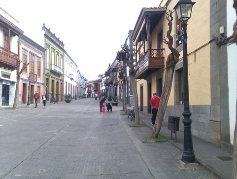
 The quaint and quiet streets of Teror
This was a few days walking in northern Gran Canaria in early 2012. The mild climate (and nice hotels) make the Canaries an appealing winter destination...
I stayed a couple of nights first in the capital of Las Palmas. The interesting old town of Vegueta is someway from the modern centre by the beach of Las Canteras. I stayed at the grand old lady of hotels, the Santa Catalina, where folk dancing takes place on Sundays and with a nice wee cafe and park behind.
Day one and two - to Tafira and Bandama
My plan was basically to head up to the ‘cumbre’ and then out back down to the coast somewhere to the west. First destination was the Hotel Escuela Santa Brigida, which, slightly confusingly is not in the town of that name, but Tafira. I had a route planned using my Kompass 1-50k map which avoided the roads, starting out above the old town to the hill of San Juan de Dios where the views really began to open out to the city and ocean below. But rather discouragingly, it was here that a dodgy looking character started flinging stones at me. I had seen him sheltering by the wall with no one else anywhere about and waved, which was returned. But then came the ping of stones landing near my feet. Although he had the advantage of higher ground, after I chucked a couple in his direction, he fortunately stopped and didn’t follow. The way headed gently up through Lomo Blanco, Tafira Baja and the surprisingly long streets of affluent Tafira Alta to arrive early afternoon.
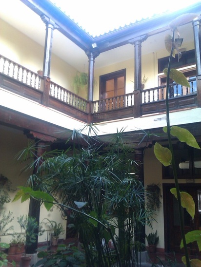
Turismo in Santa Brigida
I was stopping here for two days, so went off to see the volcanic crater at Bandama a few km away, the overlooking peak and through some local villages like La Atalaya. Mostly this was on minor roads, never too appealing, but there was a pleasant serenity in the crater bottom, with the abandoned farm and fruit trees, despite being on the island’s tourism circuit. I also visited Santa Brigida itself, where the local council is housed in a wonderful old Canarian house.
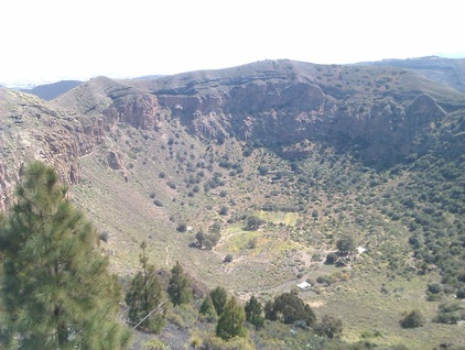
Looking down onto the Bandama crater
Days three and four - to the Parador at Cruz de Tejeda
This was where the proper walking started, as I was going to the Parador in the interior at 1500 metres, through the GC01 path. This started at Teror, the next town to the west, however, and I wasn’t sure that I could walk there, and then up to the Parador Cruz de Tejeda, in a single day. With hindsight, I think it would be do-able in a long day, but I compromised by taking a taxi about halfway to Teror, then on foot passing through fields and several splatted rats on the road. Once I found the first ‘GC01’ sign on the edge of delightful Teror, the route was a piece of cake to follow, signposted all the way. Despite the climb of four or five thousand feet, the route seemed fairly easy, climbing through the different zones: orchards, meadows and finally pines. The parador lies a few hundred feet below the high point of the path, nestling in the great volcanic caldera of Taburiente. The setting of Cruz de Tejeda is pretty tawdry, occupied by car parks, knickknack sellers etc, and the parador itself looks a hotchpotch of styles. But its fantastic inside, with amazing views of the rocks changing colour as the sun sets across the caldera, and really nice staff. There’s a modest cafe where you can eat if you don’t fancy the formal restaurant.
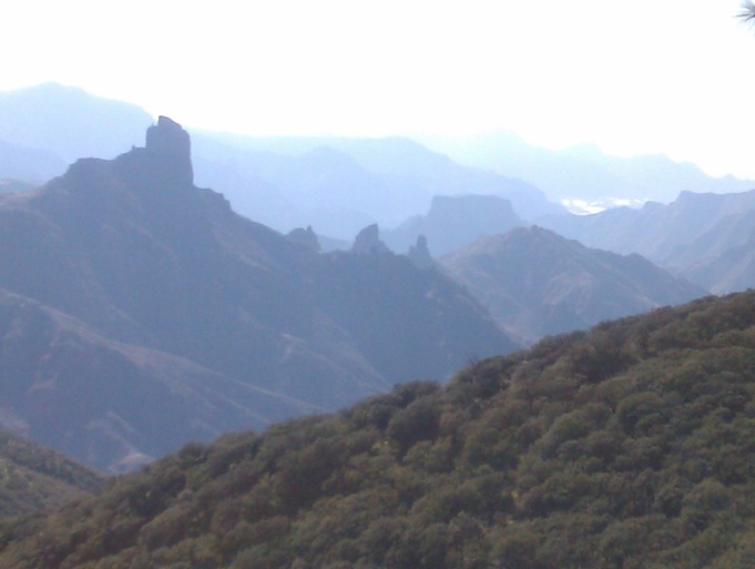
The view from my Parador room, looking west down the caldera. The polythene tomato greenhouses at San Nicolas are in the distance
A day excursion took me around some of the villages and valleys of the interior (eg Mina) , based on the Sunflower walking book and ending up with a slog up from the cute but touristy village of Tejeda itself. I had hoped to spend the next night at the village of Artenara, en route for the coast near Agaete, but there seemed nowhere to stay; too bad then - another night in the Parador...
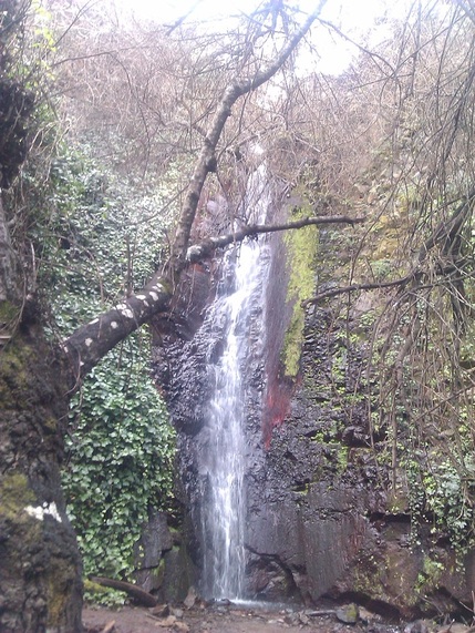
The waterfall at Barranco de la Mina...running water being a rare sight...
Day Five - Cruz de Tejeda to Puerto de las Nieves
This was the big one to finish - a long trek down to Puerto de LAs Nieves on the north-west coast. But downhill all the way! As before on this trip, the paths were easy to follow and the first section towards Artenara followed the lip of the Caldera through pine trees, with wonderful views ahead and to the left. Plenty of interesting Guanche caves too. I preferred the atmosphere in the humble villages like Lugerejos, where a local old boy was happy to chat about the drought (the reservoirs being practically empty after years of little rain) to complacent Artenara. Then followed the spectacular descent down the canyon through tiny Hornillo, clinging halfway up a veritcal cliff face. At last, the path winds through pine trees to emerge above the town of San Pedro, from where it was a further slog a few miles to the main town of Agaete. Infuriatinly, I got lost here, and couldn’t find the way to puerto de las Nieves, only a mile or two further on the coast, I ended up walking along the barranco (ravine) floor before flopping at my hotel. The town seems to attract a lot of Spanish foodies here for the fish, but it seemed a dismal end-of the-line place to me.
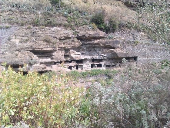
Caves above the Presa de los Perez past Lugarejos
Next time, I might take in more of the wild west side of the island - few roads or hotels and really no tourists, I think, but an awful lot of these lovely barrancos!
