The Roman road from Benaocaz to Ubrique
I did this six day walk - my longest so far - in the last week of April 2014. Before going any further, I should qualify that my actual walk started from the village of Montejaque near Ronda and ended in the town of Los Barrios, near Algeciras and close to Tarifa, where I spent a couple of days relaxing. But the walk was generally planned on the western section of the GR7/ E4 long distance path, and also used the Coast to Coast path as described in Guy Hunter Watts’ book; in its spirit I think ‘Ronda to Tarifa’ is a fair enough description.
The theme that I started out with was Roman relics; I particularly wanted to see the section of Roman road from Benaocaz down to Ubrique, and had heard that that there was another Roman road at Castellar and bits and pieces all over the place. In the end, my energy and interest were rather more spent on the birds and wildlife than on ancient remains. This was partly as a result of getting really sore blisters on my little toes; your curiosity tends to fade a bit when faced with extreme discomfort! By the time I arrived at each destination, my pace had slowed to about 1 mph...but I promise not to go on any more! Abiding impressions on reflection include just how big the Andalucian forests are, especially in the Alcornocales National Park, and how many of the villages of the interior are real tough mountain settlements - freezing at night, hot by day and no doubt harsh places to make a living.
Map-wise, a visit to Stanfords in London had furnished me with the 1:50k maps for Jimena de la Frontera and Tarifa, as well as a 1:25k for Castellar and a 1:40k for the Grazalema National Park. Together with the waymarking, these meant that I hardly got lost this time, but I have to admit that I don’t think I could have navigated the route without the directions in the above mentioned Coast to Coast book, especially in view of gaps in way marking. You can see my route at Wikiloc herebit.ly/2kHfbNn (though some the sections (e.g. between Cortes and Jimena) shouldn't be taken to literally!)
Day one: Montejaque to Villaluenga del Rosario
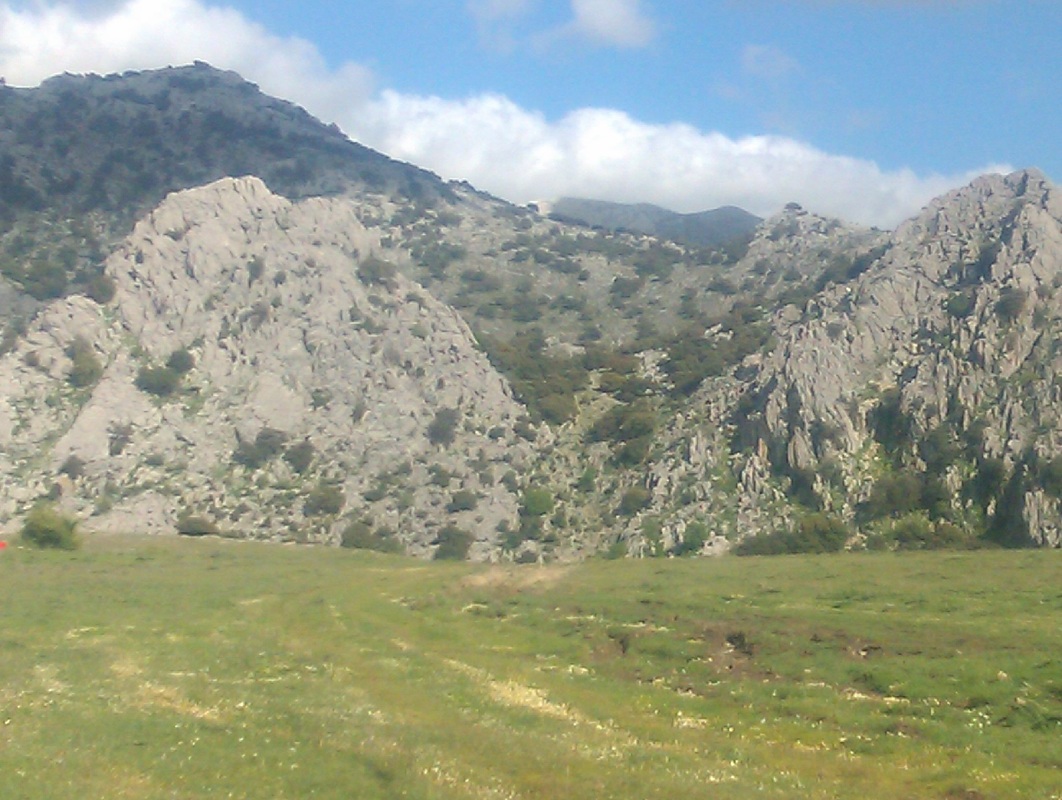
There’s only one train from Malaga to Ronda (10.05) at present, so this first day was always going to be a half day. I had originally intended staying in Ubrique, but its hotels all seemed to be booked on the dates I wanted, and I chickened out of turning up on spec. As it turned out, I don’t think I could have got there from Montejaque anyway in the time. So I caught the 1.30 bus from Ronda to Montejaque, worrying on the way that the cool winds and dark clouds above indicated a miserable afternoon ahead. As it turned out, the sun came out and the weather stayed perfect the whole week, a little hotter day by day. As I set out on the start of any long walk I always think of Mao’s maxim that ‘every Long March begins with the first step’ and soon left the village behind. The route was very simple, at least initially, heading over the pass west of the village to the Llanos de Libar, walking along a broad track through two isolated dry valleys in ‘dehesa’ landscape (oaks and pasture), surrounded by high limestone cliffs on either side.
These dry enclosed limestone valleys, where rainfall seeps through the rock rather than form rivers, seem to be known as a ‘polje’ in Spanish. On reaching the pass, you get a great view south west down the first valley, and a massive bird of prey flew overhead - this was I think some sort of eagle, the only one I saw.
After several kilometers (and meeting a party of walkers from Edinburgh - small world!) a GR7 post at a wall across the valley directs you west, across the first of two ridges that takes you to Villaluenga. However, there was a massive, and apparently very angry bull bellowing in the field, as well as a broad boggy section of river. I therefore crossed the little river on the other side of the wall, clinging to the barbed wire fence on top, escaping with only a minor scratch and a wet boot. This was the first of several encounters with unpleasant fences. A footpath then quickly takes you out of the valley to the Paseo del Correo, with a longer descent down into the next, lower, dry valley, the Llanos del Republicano. This soon joins a concrete track taking you over the next low ridge and on to Villaluenga. All today’s walk was at altitudes between roughly 800- 1000 meters.
Day two: Villaluenga del Rosario to Ubrique and back
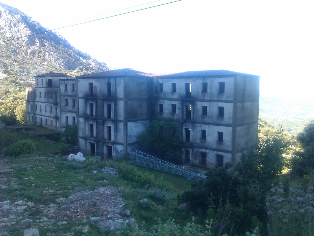
The abandoned Hostal Agua Nueva above Ubrique
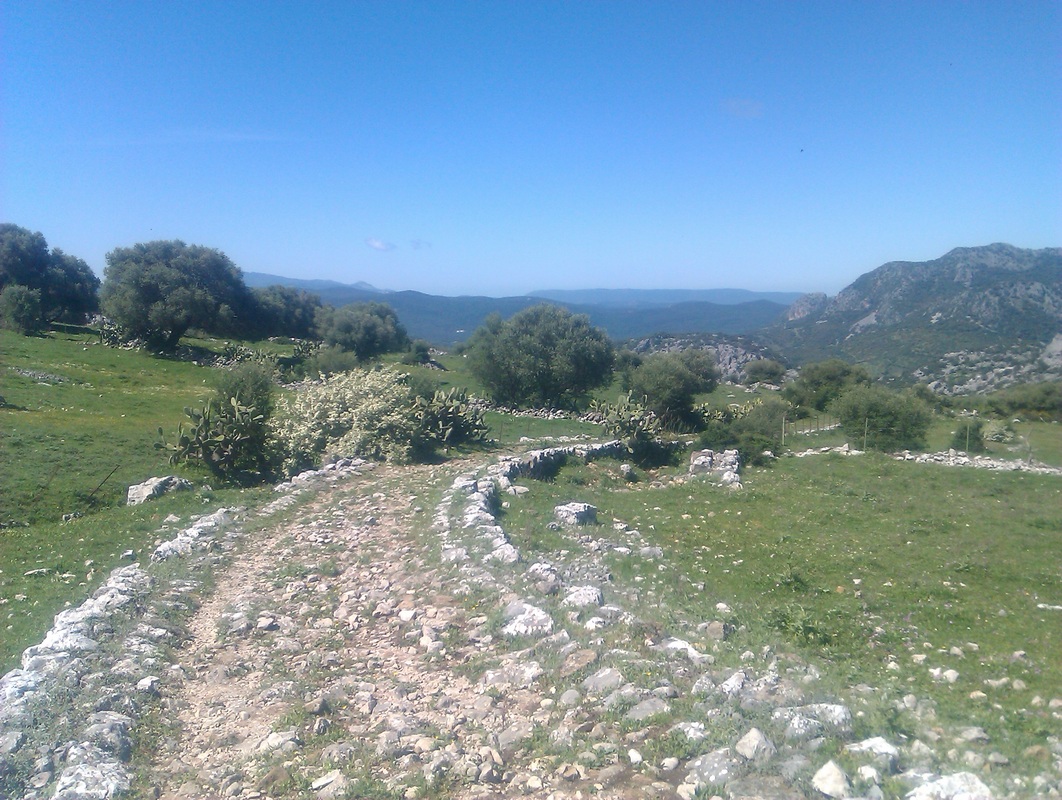
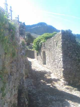
 Section of old road through La Manga de Villaluenga
The main object of this day was to visit the Roman Road down to Ubrique, and possibly visit the Roman site of Ocurri on the adjacent hill. As you leave Villaluenga, a tourist noticeboard draws attention to the remains of a short section of old road and fountain. The GR route follows just south of the main road, through the fields of ‘La Manga‘ apparently populated since prehistoric times, and I was surprised that the route in places was formed by a well constructed cobbled road, clearly of some antiquity. At one point the path crossed a fence though the cancela (simple wire-and-post gate) was tied with a piece of nylon string, making it unpassable. It seems that there are many access problems where landowners obstruct passage, even on a so-called trans-European route like this (E4). Fortunately, my plastic picnic knife enabled me, and perhaps others. to proceed...
Where the road bends sharply to Benacoaz, a mirador gives a fine view to the west, and another section of old road appears, just before the Hostal Agua Nueva. The massive unfinished and abandoned hotel is quite a sight, sad and somewhat sinister.
Where the road bends sharply to Benacoaz, a mirador gives a fine view to the west, and another section of old road appears, just before the Hostal Agua Nueva. The massive unfinished and abandoned hotel is quite a sight, sad and somewhat sinister.
 Barrio Naziri, Benaocaz
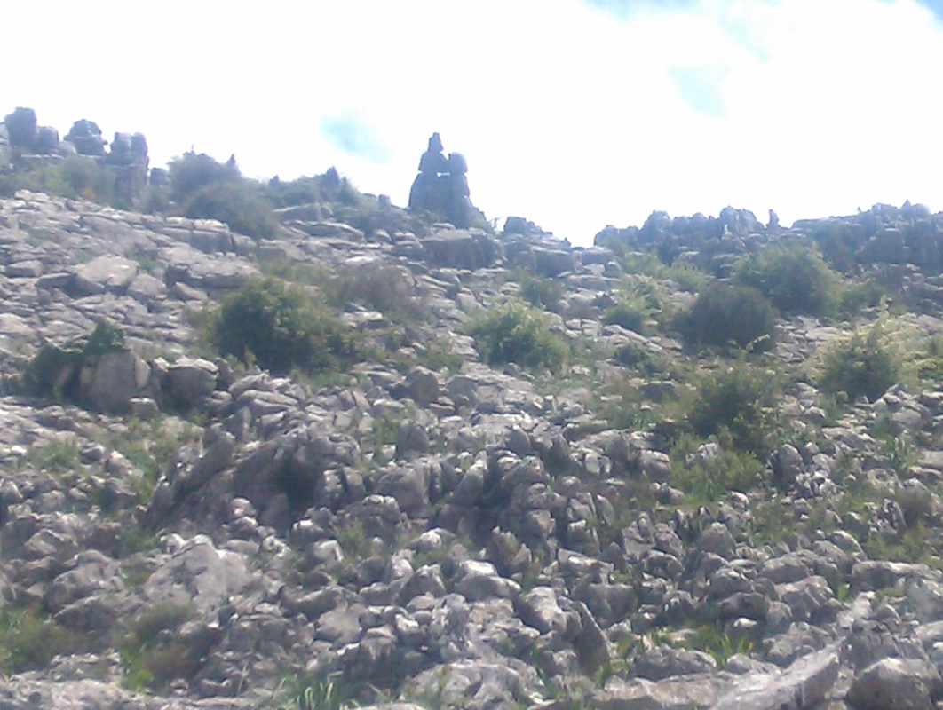
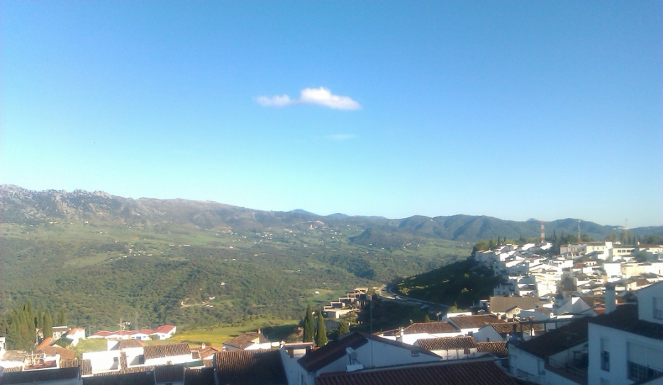
Benaocaz seemed a pleasant village (nicer than Villaluenga) with some interesting ruined houses at the top, the remains of the Barrio Naziri, an old Arab quarter and various tracks heading into the mountains towards Grazalema to the north. The beginning of the Roman road to Ubrique is easily found, though the first section seems much like any other path. It improves in condition as it heads down 400 meters to Ubrique; partly this is attributed, as I understand it to the maintenance it received in medieval times as it was the main route out of Ubrique until relatively recently. I supposed here that the concept of a ‘Roman Road’ in this part of the world at least is a little simplistic; very often those sections of ancient road which remain now owe this to being used, reinforced and rebuilt over the centuries, rather than ‘preserved’....The way back pretty much retraced my steps, skipping Benaocaz but I gave Ocurri a miss, as it would take me several km out of my way. Its probably not a must see site, but maybe another day.
Another section of old road - just as Roman-looking? - disappearing under the modern road beside the ruined Hostal...
Day three: Villaluenga del Rosario to Cortes de la Frontera
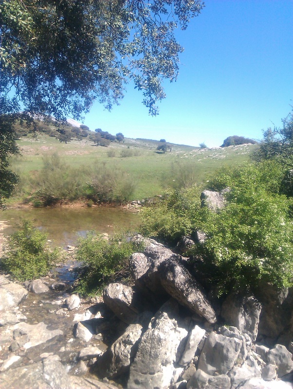 A pool at the mouth of the Sima del Republicano
After two nights in Villaluenga, not the most animated of places, I was keen to move on. My route headed back the way I had come on the first day to the Llanos de Libar, but on the way I took the short diversion to see one of the caves of this limestone country, the Sima del Republicano, the cave which swallows the small river in the valley. Here I stopped to watch a flock of bee eaters darting about above the little river, with their wonderful green and orange plumage shining in the sun. A lovely spot.
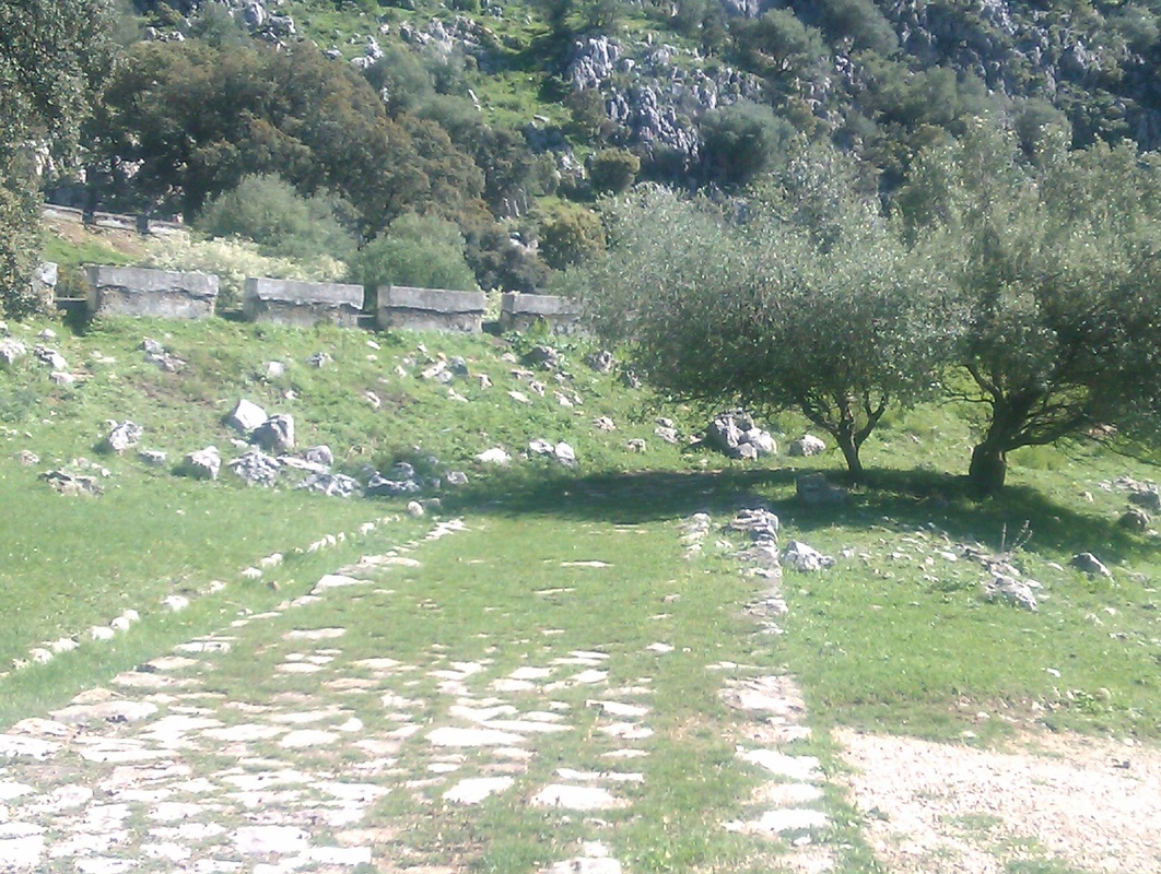
 The Paseo del Correo looking east from Los Llanos del Republicano
Back over the Paseo de Correo once more, I thought I would be clever and stick to the right hand side of the valley as I turned right along a track, avoiding both the boggy river section and bull of the first day. A fox trotted out of the undergrowth before spotting me and darting back, and this was fine until. as the valley finally ended and I needed to climb over the ridge to Cortes on the other side, there seemed to be impenetrable fences across the whole valley. After some difficulty, I managed to get over one (they all have barbed wire on the top), and after stumbling on the fresh carcass of a large cow, traversed a small hill to get to the gap in the valley wall. Waymarking and the Coast to Coast book pointed out a number of nice old cobbled routes between the forestry tracks, down through the stones and wild flowers.
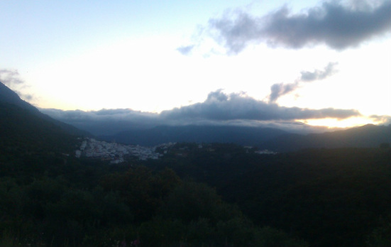
I had half a mind to see if I could find any vestiges of ‘Cortes El Viejo’, as the original Roman precursor to Cortes is apparently known, supposedly located on the Sierra Blanquilla only 2km from the modern town. After one half-hearted plunge into thorn bushes on a likely-looking hill top, it soon became clear that this was what an Irish friend would call ‘a fools errand’. By the time I arrived in Cortes, the cold beer tasted very good, and my little apartment ‘Quercus’ was a delight, with a fantastic view and a little pool that I refreshed myself in briefly. As I had an early start the next day, I was happy to stay in to watch the sun set over Jimera de Libar on the other side of the Guadiaro valley and dine on supermarket fare.
I had half a mind to see if I could find any vestiges of ‘Cortes El Viejo’, as the original Roman precursor to Cortes is apparently known, supposedly located on the Sierra Blanquilla only 2km from the modern town. After one half-hearted plunge into thorn bushes on a likely-looking hill top, it soon became clear that this was what an Irish friend would call ‘a fools errand’. By the time I arrived in Cortes, the cold beer tasted very good, and my little apartment ‘Quercus’ was a delight, with a fantastic view and a little pool that I refreshed myself in briefly. As I had an early start the next day, I was happy to stay in to watch the sun set over Jimera de Libar on the other side of the Guadiaro valley and dine on supermarket fare.
Part of the view over Cortes from Apartamiento Quercus
Day four: Cortes de la Frontera to Jimena de la Frontera
 Dawn beaks over Cortes
There always seems to be one day which is ‘the big one’ on my walks and today was it. I aimed to head west, joining the GR7 as it headed south from Ubrique. My main concern was that I reckoned I needed to make a short cut from the route along the minor MA512 road, past la Pulga river a couple of hundred meters up the west bank, to join a track that led to the GR at La Calderona. This would cut 4 or 5 km off the walk and make the route do-able in the day. Without the short cut, I wasn’t sure that I could do it. So an early start was required and I left the flat at 7.10 am, a little surprised at how dark it was. The sun soon came up over Cortes to the east as I quickly covered the 4 km to the turnoff, passing on the way a mountain goat tangling with a roadside fence (it seemed ok).
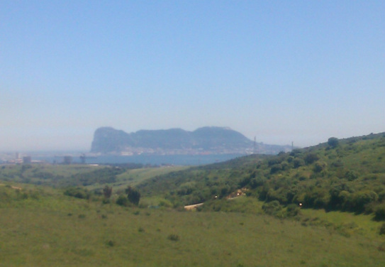
 Gibraltar and the sea become just visible in the notch above la Pulga
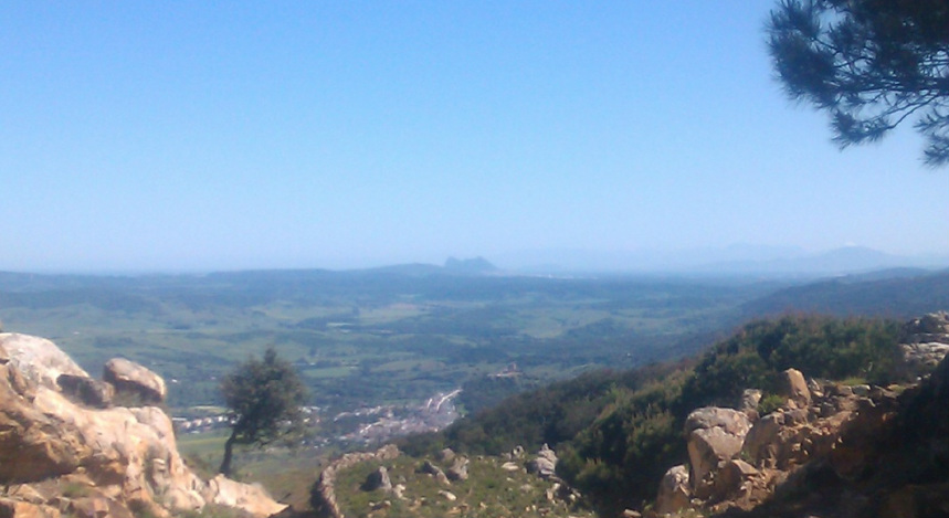
Turning off left down the MA512 to la Pulga, the limestone mountains were left behind and the really dense cork oak forests began. Suddenly and unexpectedly, there was a glimpse of the sea far away, with a distinctive tooth-shaped rock - Gibraltar. This became a regular landmark, closer each time of course, and it struck me what a distinctive landmark it is for so far around (and no doubt an irritating reminder to the Spanish of the British presence).
I passed a noticeboard about the birds of the area near the valley floor, but today I saw hardly anything despite being in the forest most of the day; maybe a result of being on the move constantly.
I passed a noticeboard about the birds of the area near the valley floor, but today I saw hardly anything despite being in the forest most of the day; maybe a result of being on the move constantly.
Using the Grazelema map, I had tried to identify the exact point that I needed to cut off right up the slope to the right to join the track and the GR7. This followed a firebreak in the forest which had seemed clear enough on Google Earth - but from ground view it is never the same. On reaching what I thought was the right spot, I headed off the road and up through the woods. Sure enough, the firebreak was clear and easy to follow, and remained so until I had reached the crest after about half an hour’s climb. This was also marked on my map as an old ‘via pecuaria’ - the old drove roads that crisscross Spain, though as often seems to be the case, there is now no discernible trace of the old right of way. I got to the junction with the GR7 at la Calderona just after 11 o'clock, four hours after starting, just as I had calculated. It's nice when things work out as planned!
I was conscious though that this was only about a third of the way to Jimena. Also, I had reached the bottom of my 40k Grazalema map, and hadn’t yet joined the path described in the ‘Coast to Coast’ book. I feel pretty lost without a map so I hoped the waymarking was OK. In this section it was; there were sign-posts to be found at the odd fork where a decision on route choices had to be made, though later on in the path however, the signage practically disappears. The next couple of hours were spent on broad forestry tracks along hill crests, with views across the oak forest to the west especially. The path then plunges deep into the woods, along fern-bordered streams, descending all the time. Eventually, you come out of the woods to more tracks with open views, including Jimena below its arabic castle and the rock of Gibraltar, obviously much nearer now. Another old stone track led down to the town itself, where I stayed at the very lovely Casa Henrietta.
I was conscious though that this was only about a third of the way to Jimena. Also, I had reached the bottom of my 40k Grazalema map, and hadn’t yet joined the path described in the ‘Coast to Coast’ book. I feel pretty lost without a map so I hoped the waymarking was OK. In this section it was; there were sign-posts to be found at the odd fork where a decision on route choices had to be made, though later on in the path however, the signage practically disappears. The next couple of hours were spent on broad forestry tracks along hill crests, with views across the oak forest to the west especially. The path then plunges deep into the woods, along fern-bordered streams, descending all the time. Eventually, you come out of the woods to more tracks with open views, including Jimena below its arabic castle and the rock of Gibraltar, obviously much nearer now. Another old stone track led down to the town itself, where I stayed at the very lovely Casa Henrietta.
Gibraltar looks a bit closer as Jimena and its castle - and in the distance, Africa - come into view
Day five: Jimena de la Frontera to La Almoraima
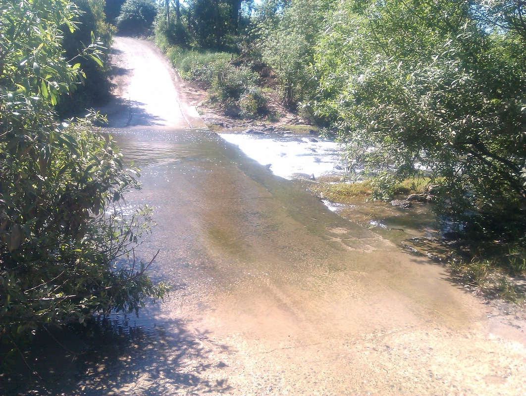 The ford across the Rio Hozgarganta at La Bordalla
Often the hardest part of navigating seems to be the very first bit - once you find the right track, you are usually...on track. But I started out on the wrong track today, carelessly missing the bridge over the Rio Hozgarganta that led to the path alongside the railway and finding myself in the Los Angeles barrio at the station. Looking at my map, it wasn’t clear that there was another bridge across to the west side of the river where my route was for at least a dozen kilometers; the decision was therefore whether to return north a km or two to Jimena, or start trudging south along the main A405 towards Algeciras. It takes a lot for me to persuade me to retrace my steps - totally illogically - so I set off down the busy road. Three or four km on, a sign to the right indicated ‘La Bordalla’; would this take me across the river? A motorist coming up the track seemed to say that yes, you could cross the river, if you took your shoes and socks off.
Sure enough, there was a ford just down the road and I even got a lift across the foot-deep river from another passing car.
Sure enough, there was a ford just down the road and I even got a lift across the foot-deep river from another passing car.
I was now back on track; for several km the path follows the railway south in pleasant country near the river with lots of birds of prey circling (mostly buzzards, I think, but I also watched a pair of kestrels closely for a while) and what I think were stonechats on the wires. Trains are few, some freight trains and three passenger trains a day I think from Algeciras to Ronda and Granada. There are many totally unguarded railway crossings which wouldn’t be allowed here, I’m sure. Heading further south, the countryside gave way to big arable-industrial fields that began to be a chore, similarly on the other side of the tracks after crossing to head up towards Castellar.
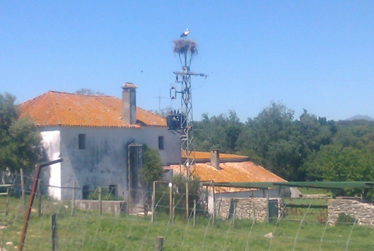
After the fields, and my first sighting of a nesting stork at Cortijo la Matillas, the path follows an old cobbled road, dreadfully eroded in many places. I thought I should keep an eye open for Roman coins, and immediately found a coin...2 euros; happy with that. The endlessly winding upward course, eventually became asphalt and arriving in the hilltop settlement of Castellar, I downed two quick Fanta naranjas, but chose not to hang around and explore, having another half dozen km or so to go. But Castellar looked an interesting place to explore for many reasons, both historic and social (the well-known story of its occupancy by ‘hippies’).
After the fields, and my first sighting of a nesting stork at Cortijo la Matillas, the path follows an old cobbled road, dreadfully eroded in many places. I thought I should keep an eye open for Roman coins, and immediately found a coin...2 euros; happy with that. The endlessly winding upward course, eventually became asphalt and arriving in the hilltop settlement of Castellar, I downed two quick Fanta naranjas, but chose not to hang around and explore, having another half dozen km or so to go. But Castellar looked an interesting place to explore for many reasons, both historic and social (the well-known story of its occupancy by ‘hippies’).
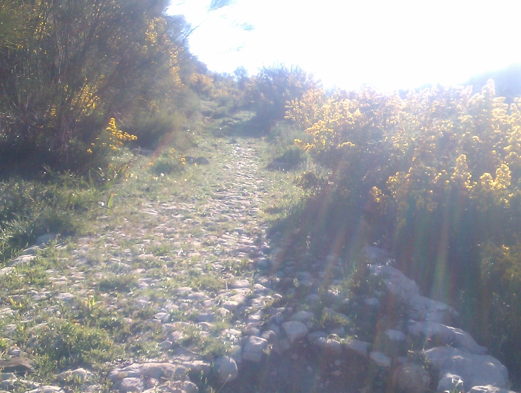
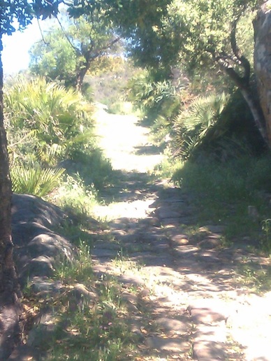 The calzada romana at Castellar
Heading down southwards, the path follows another ‘calzada romana’ seemingly in almost perfect condition, though narrower, and much less promoted that the Ubrique one.
Once down, now at only 100 meters or so altitude and the weather warm, the path followed roads through more cork oak woods to my stay for the night, another lovely place La Almoraima, a former 17th century convent where the beer tasted good again. I spotted a woodpecker just before arriving (Greater Spotted) but was now pretty knackered; especially as I had walked past the back entrance to the hotel on the CA9201 and had to retrace my steps to get in (the main entrance turns out to be more than a kilometer further south, off the main road).
Once down, now at only 100 meters or so altitude and the weather warm, the path followed roads through more cork oak woods to my stay for the night, another lovely place La Almoraima, a former 17th century convent where the beer tasted good again. I spotted a woodpecker just before arriving (Greater Spotted) but was now pretty knackered; especially as I had walked past the back entrance to the hotel on the CA9201 and had to retrace my steps to get in (the main entrance turns out to be more than a kilometer further south, off the main road).
Day six: La Almoraima to Los Barrios
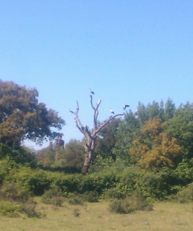
This was my last day of walking; I had originally half-thought about trying to get to El Pelayo in a day, but on doing the sums, I realised that this would be over 40km and was totally unrealistic. The highlight of this section was the storks; following the Coast to Coast instructions, I almost immediately saw what I thought for a second was a microlite aircraft, but was a massive stork flying above. The fields, especially where they have electricity pylons, are full of nesting storks, some with chicks, making a cheerful and entertaining sight. A small lake near San Roque was also home to terrapins the size of dinner plates.
The second part of the day’s route follows a back road (the CA5121) to the unremarkable town of Los Barrios and was frankly a little boring, especially with the trucks from nearby quarries passing constantly. On arriving, I reluctantly took a taxi to my hotel near Tarifa, as there was only the occasional bus to Algeciras, which I didn’t realise was quite so close; if I had my time again, I think it would have been better to skip Los Barrios altogether, walk on beside the railway towards Algeciras, and then catch the bus from there. However, just above Los Barrios, I came across a mixed flock of 30 or so bee eaters and a few bright blue rollers, all perched on the wires above.
The second part of the day’s route follows a back road (the CA5121) to the unremarkable town of Los Barrios and was frankly a little boring, especially with the trucks from nearby quarries passing constantly. On arriving, I reluctantly took a taxi to my hotel near Tarifa, as there was only the occasional bus to Algeciras, which I didn’t realise was quite so close; if I had my time again, I think it would have been better to skip Los Barrios altogether, walk on beside the railway towards Algeciras, and then catch the bus from there. However, just above Los Barrios, I came across a mixed flock of 30 or so bee eaters and a few bright blue rollers, all perched on the wires above.
The views south to Morocco had also become spectacular, with range after range of African mountains in Africa visible in the clear air - a sign apparently of the ‘poniente’ (westerly wind).
And needless to say, the rock of Gibraltar now loomed large and close.
And needless to say, the rock of Gibraltar now loomed large and close.
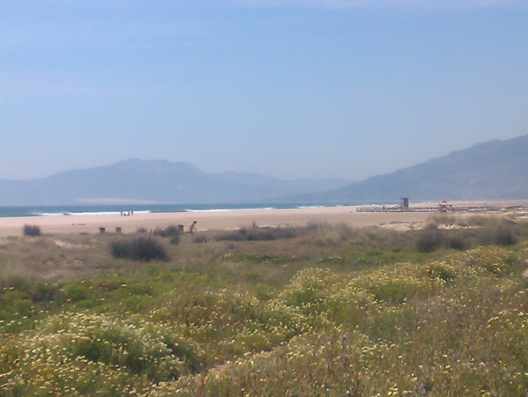
The Atlantic Ocean at Tarifa
