Sierra de Gredos
I spent a week in May 2015 in the Sierra de Gredos, part of Spain’s central mountain system around 200km west of Madrid after a weekend in Madrid with my wife Clare. I had spent two lazy weeks in the area many years before (ie 1980s) with my lovely friends Matthew and Angela who themselves spent the entire summer in a relative’s finca near the small town of Candeleda. “Sierra de Great Doss” Matthew called it. When I asked him for any up to date tips before leaving he just suggested that I find the best local restaurant and enjoy some good lunches. But I had some hiking to do…
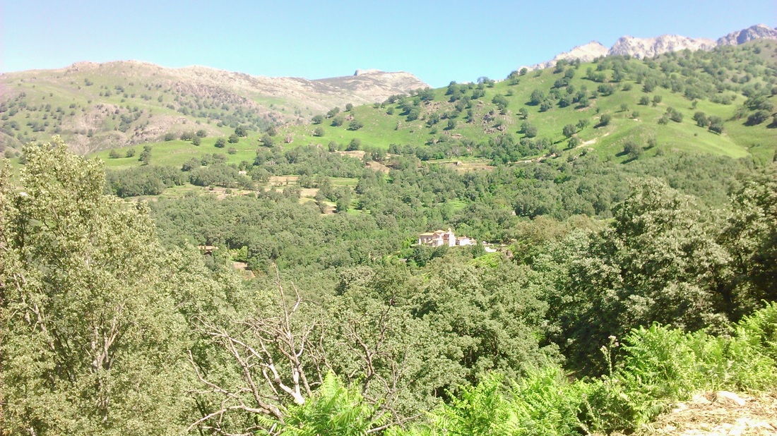
My objective was to try to see both sides of the Sierra - the hot, steep southern flank, down to the huge wide valley of the Tiétar river and the much higher northern side which gently slopes down to the young the Rio Tormes before it goes on to flow into Salamanca and beyond. I wasn’t aiming to climb the highest peaks, clustered around Almanzor, at 2,592 metres, but did want to see at least some of the great high granite ridge, which runs at more or less 2,000 metres above sea level for a good 50 kilometres. I also wanted to see the Roman road crossing the pass at Puerto del Pico I had seen before, although then it was unmarked and seemingly pretty much unknown.
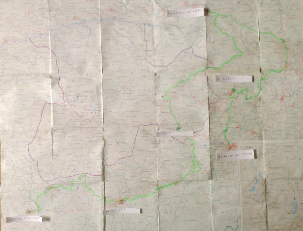
For maps, I used the the Editorial Alpina 1:25000 Sierra de Gredos and the CNIG Macizo Central de Gredos 1:50,000: as I’m still trying to work out how to use digital maps properly, I’ve used this map to show my route (in green).
My objective was to try to see both sides of the Sierra - the hot, steep southern flank, down to the huge wide valley of the Tiétar river and the much higher northern side which gently slopes down to the young the Rio Tormes before it goes on to flow into Salamanca and beyond. I wasn’t aiming to climb the highest peaks, clustered around Almanzor, at 2,592 metres, but did want to see at least some of the great high granite ridge, which runs at more or less 2,000 metres above sea level for a good 50 kilometres. I also wanted to see the Roman road crossing the pass at Puerto del Pico I had seen before, although then it was unmarked and seemingly pretty much unknown.
For maps, I used the the Editorial Alpina 1:25000 Sierra de Gredos and the CNIG Macizo Central de Gredos 1:50,000: as I’m still trying to work out how to use digital maps properly, I’ve used this map to show my route (in green).
Day one - up the river to El Arenal
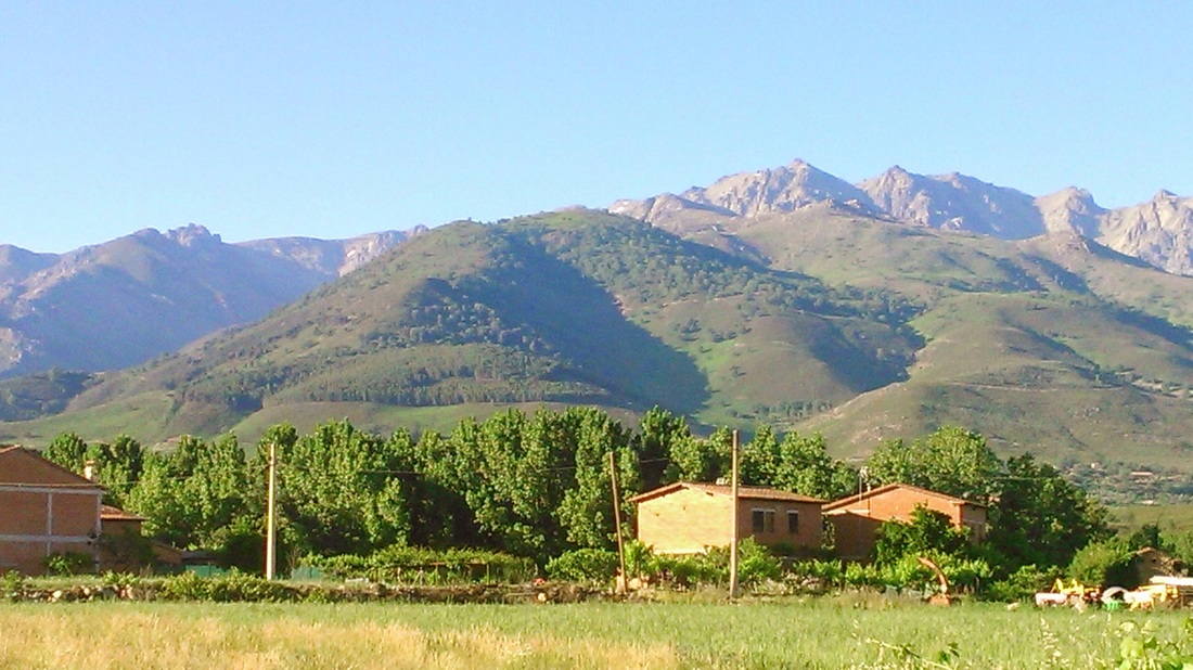
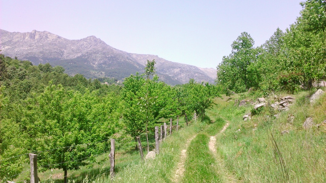
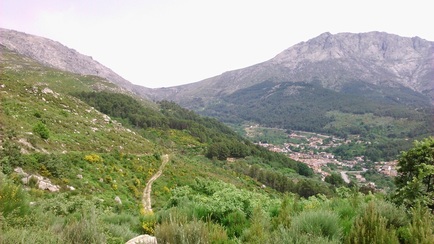
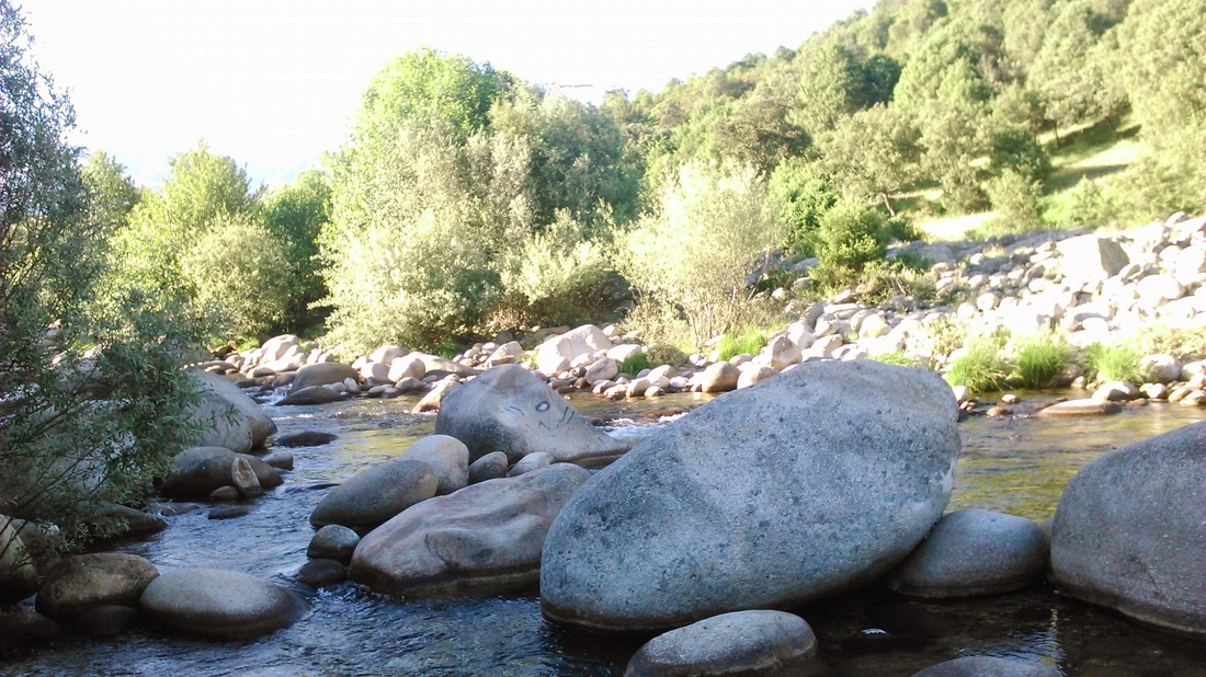
Arriving off the Madrid bus in Arenas de San Pedro at lunchtime, my first afternoon was an easy 9km walk up the river to the small village of El Arenal. The gentle upward route starts near the sports centre and is well way-marked as part of the GR180 long-distance path, following the river bank and passing many pools on the way.
At the higher levels, cherry orchards become common and the views of the Gredos mountains, some still flecked with snow, open up. After crossing the river you head up to the village itself at about 900 metres altitude. Although it has a population of only 1,000, like many Spanish villages it has managed to retain lots of community facilities; supermarket, butchers etc and of course several bars. I spent the night at the pleasant and reasonable Hotel Los Molinillos, before a stiffer test the next day.
Day two - across the Puerto del Pico to the northern slopes
The plan for the day consisted of three sections - firstly some 13 km to the village of Cuevas de la Valle, then a 4km and 540 metre climb up the Roman road to the mountain pass of Puerto del Pico (1389m), and finally another 13km or so to the Gredos Parador on the north side of the range.
Setting out, the way again followed the GR180. The way-marking of these routes, with French-style red and white markings, including indications for wrong turns, seemed much better than I had found in Spain before.
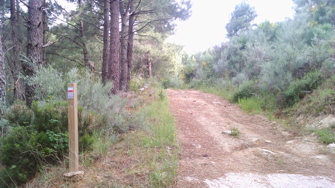
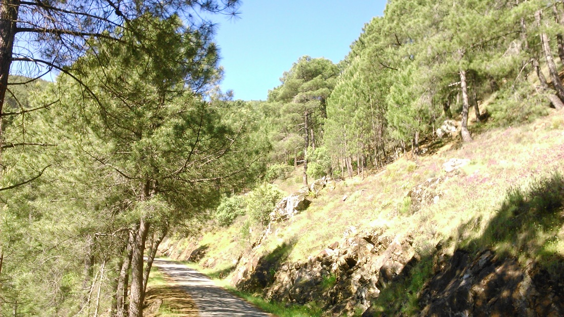
At first the path followed easy tracks through the pine forest on the west side of the La Penca hill that separates the villages of Mombeltran and Cuevas de la Valle from El Arenal. Just over an hour later, the path comes out of the pine trees abruptly into open land cloaked in broom - the relic apparently of a massive fire in 2009 that burnt down the pine forest; a few lonely charred trunks are all that remain although here and there, young pines are appearing.
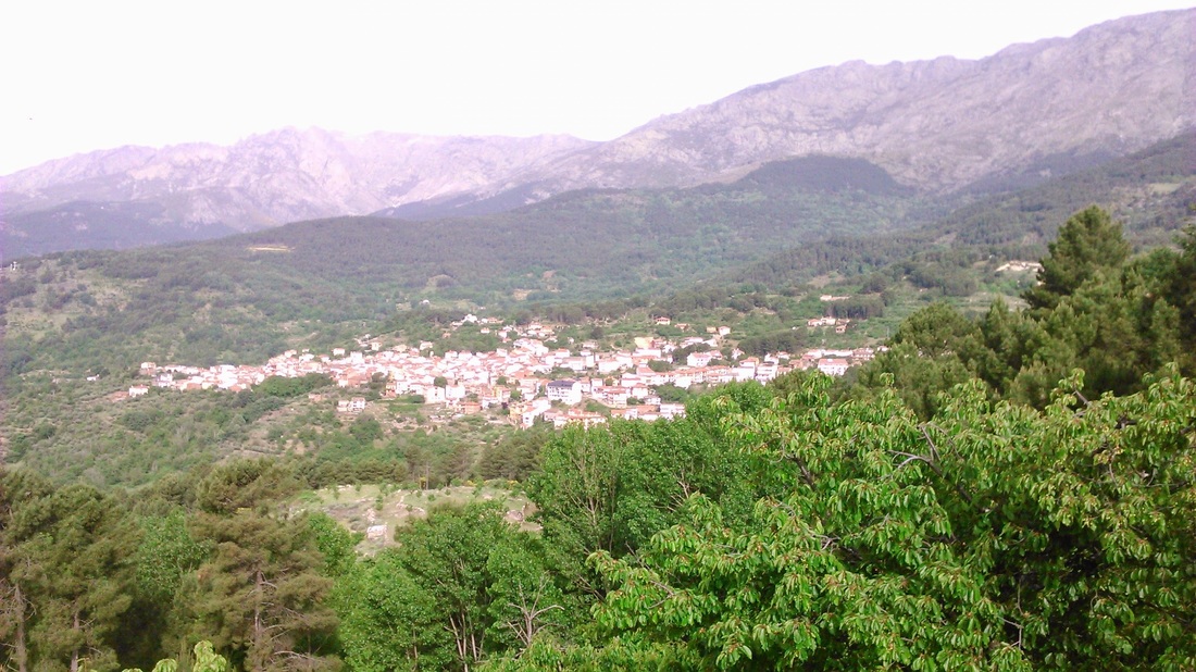
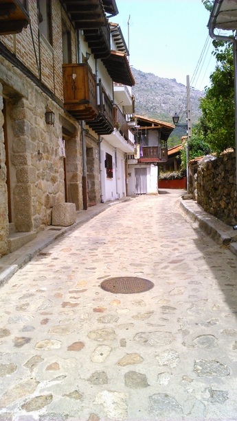
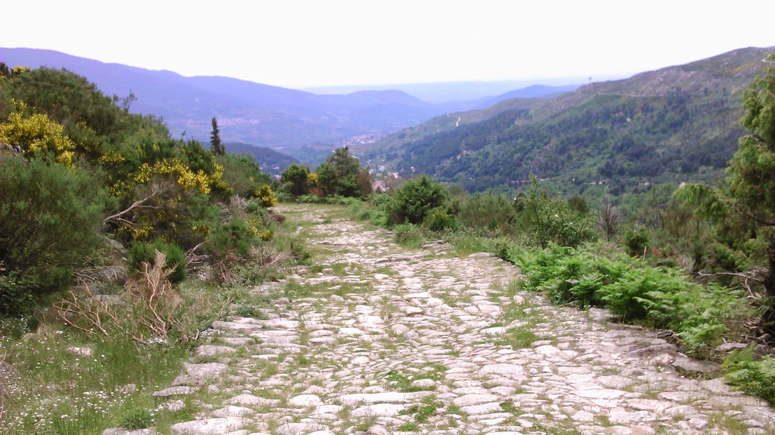
Mombeltran came into view below, with the wall of mountains rising above. Having left the GR180, I managed to find the right path down into Cuevas. By the time I arrived, I had already done four hours, one more than I had budgeted and refilled my bottle at a fuente in the village street which follows, I think, the route of the Roman road.
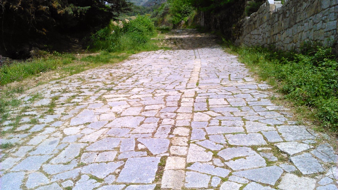
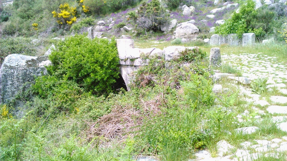
Once over the river, the ‘Roman’ road began at an interpretative board and a completely reconstructed, pristine section of stone-paving. It was wider than I had expected, and I read alternative interpretations of just how ‘Roman’ it is, with some suggesting that what you see is rather a mediaeval construction following the old Roman route. Certainly the path also follows a ‘via pecuaria’, one of the old Spanish drove roads where animals have been moved from summer to winter pasture for centuries. |
|
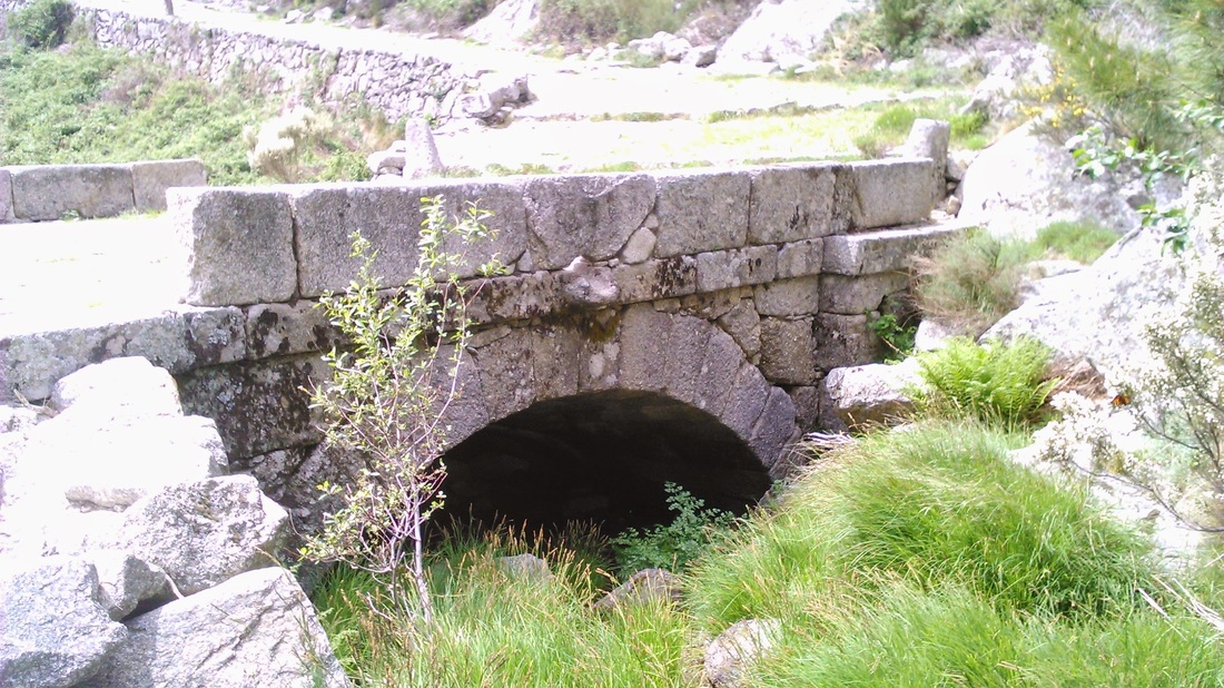
For now, the main problem was the heat, well into the 30s and a remorseless climb which took another full two hours. The road includes several bridges and culverts over water channels and dozens of curious roadside stone pillars. Wild flowers were everywhere.
|
|
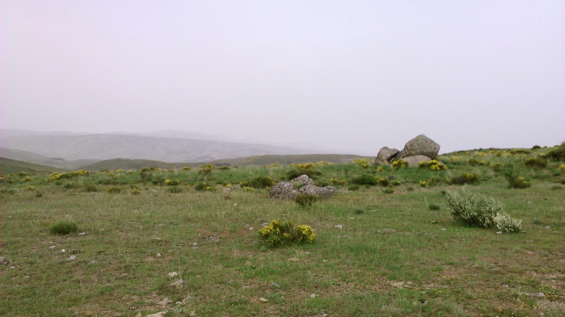
After passing the ruins of the portazgo (drove tax collection post), the pass was finally reached. I was almost out of water again already (1.5 litres is not enough for this kind of walk!). I hadn’t been sure how easy this last section would be; although it continued to follow a via pecuaria marked on the map, I wasn’t sure that this would mean an easy-to-follow route on the ground. As it happened, the route was signed - this time part of the GR10 long-distance footpath and was mostly a broad sandy track.
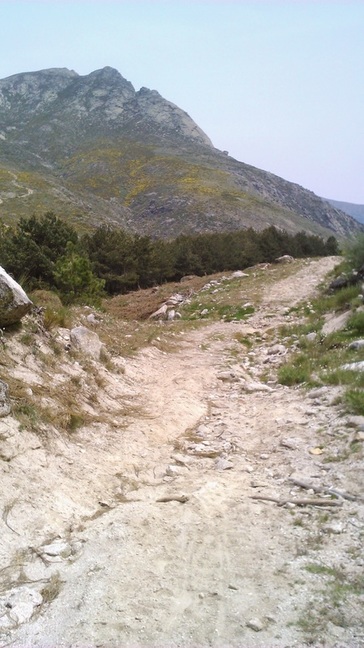
Counter-intuitively, having reached the pass, the way continued to go uphill, following the flanks of the mountains to the left; I realised that the Parador, my destination for the night, was nearly 200 metres higher than the pass I had just crossed. |
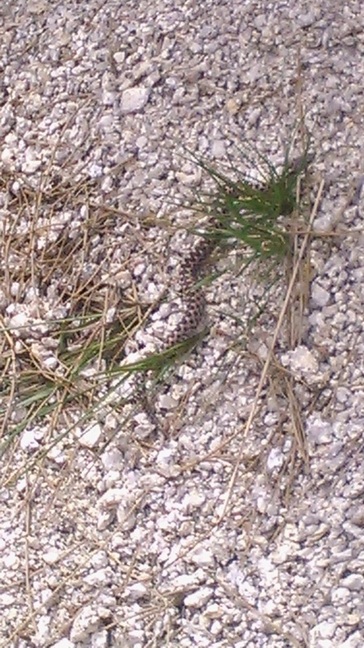
Soon after starting out, I nearly stepped on a small adder which was trying to escape me with difficulty up a sandy bank. I came across a second one just before the Parador this time, unfortunately having just been killed by a Spanish couple collecting firewood. I tried to make the case for leaving such creatures alone, but they were having none of it and I was too late to save this one anyway.
|
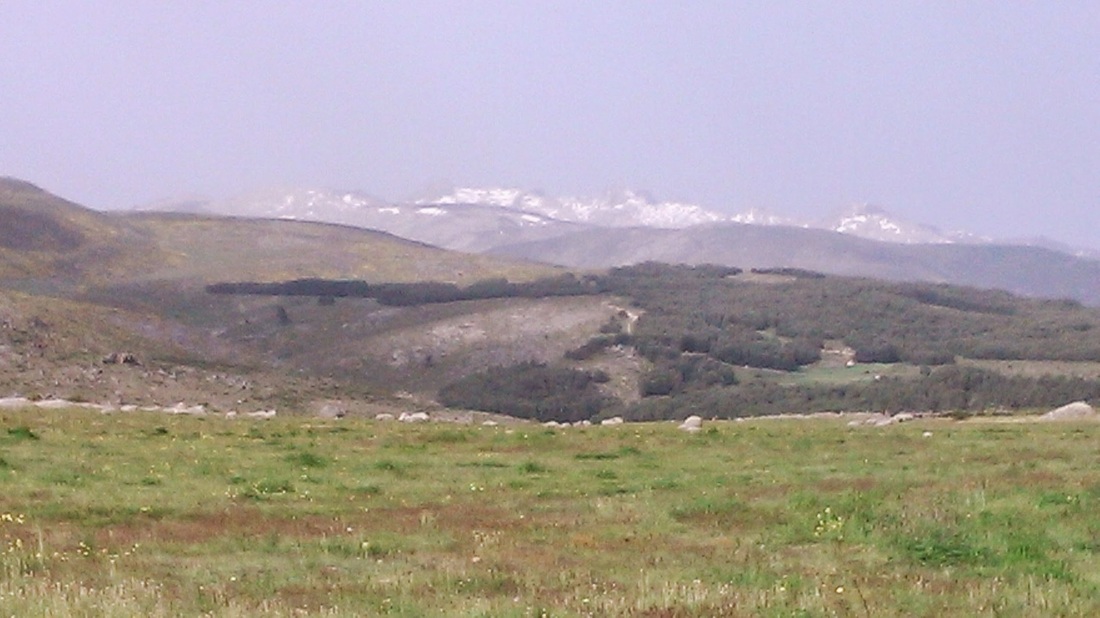
Looking to the north and east, the landscape was high moorland, pasture and dark forest - quite different from the southern slopes and not altogether unlike Scotland in fact.
Four hours after reaching the pass, I arrived dehydrated at the lovely Parador and sank a few beers.
Day three - over the high mountains to Guisando
This was to be a memorable day, for both good and bad reasons. My plan was to cross the mountains again to the Hostal Fogón de Gredos near Guisando on the the southern side, but this time taking in the crest of the mountains on the way, from the Puerto de la Cabrilla to the los Galayos gorge.
After a fairly uneventful start heading south from the Parador towards the mountains, I missed a right turn on my map. This meant that not only did it take me an hour longer to reach the crest at one o’clock, I also turned up at the Puerto del Arenal - a good hour’s walk further to the east. I was also completely disorientated: turning right on the crest, as seemed the obvious way, I looked behind me only to to see the high snowy central peaks to the west! Somehow I had arrived at the top from the south. I met a Spanish couple who I told my plans. “Queda mucho!” the woman simply said - I translated roughly as “there’s a lot left to do!”.
|
|
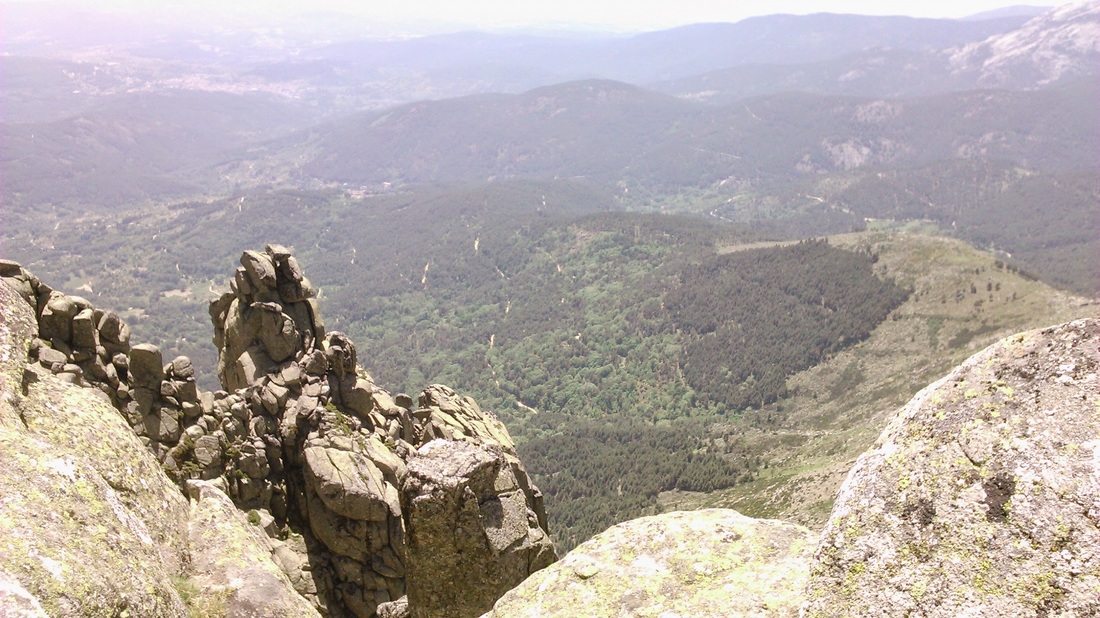
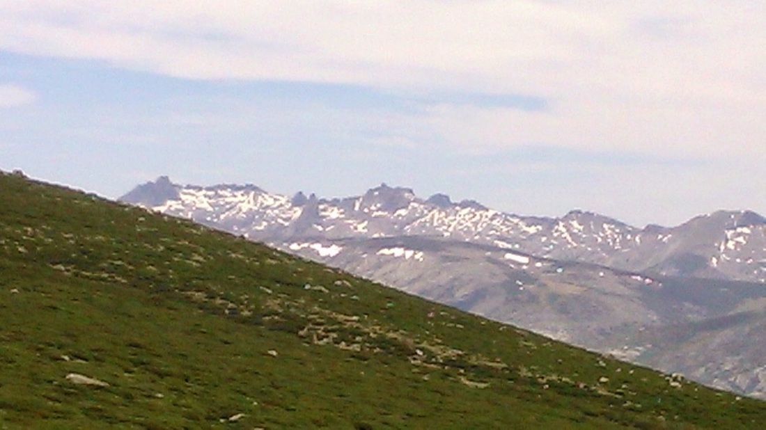
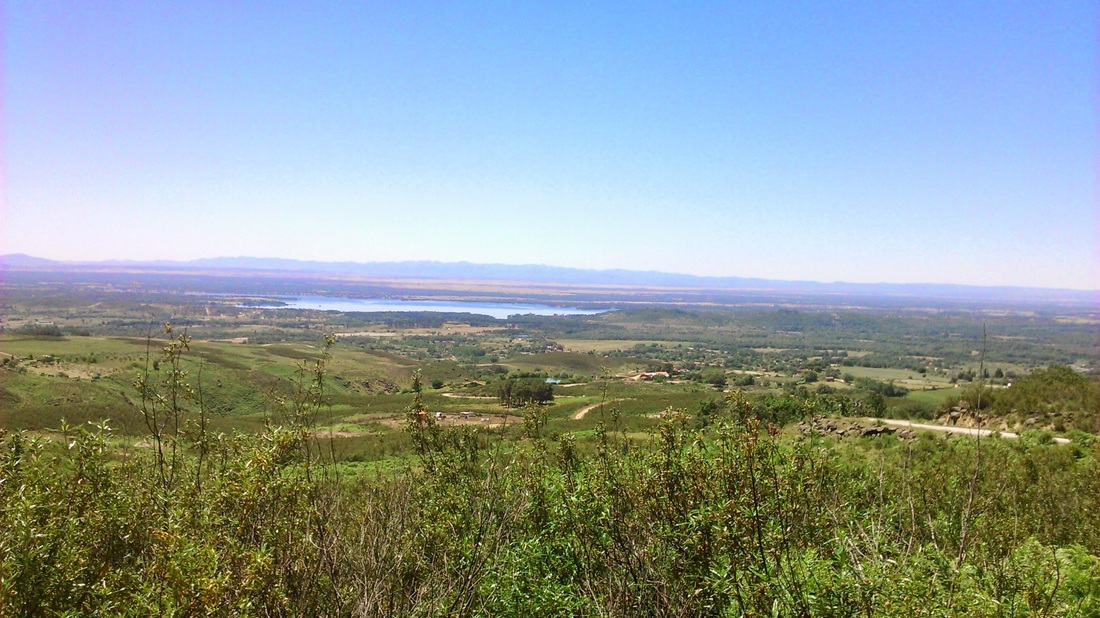
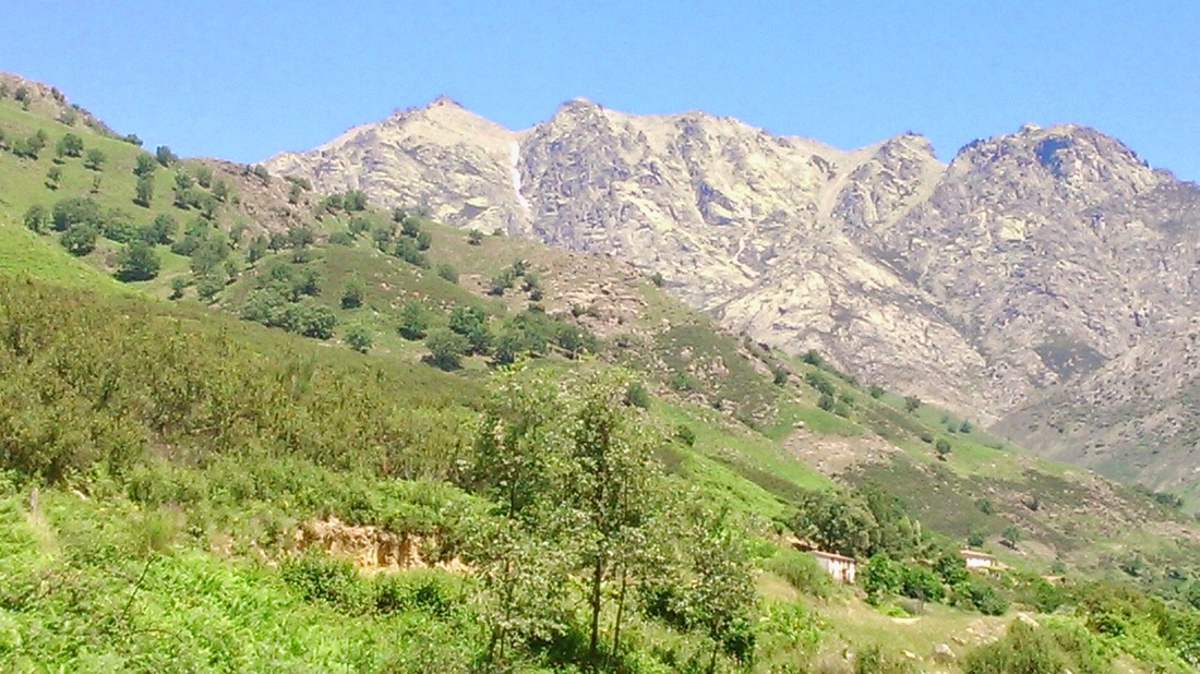
Already well behind schedule, I followed the cairns along the crest westward, sometimes through boulders, often through the broom which is a real struggle. However, the views to the south were fantastic - the reservoirs in the great Tiétar valley shimmering hundreds of metres below; eagles and vultures wheeling around on thermals and calm, warm weather even at 2000 metres. Although the ridge looks pretty level from a distance, the crest rises and falls by around 200 metres to peaks such as Mediodia, which made for slow going and I was acutely aware how much behind schedule I was.
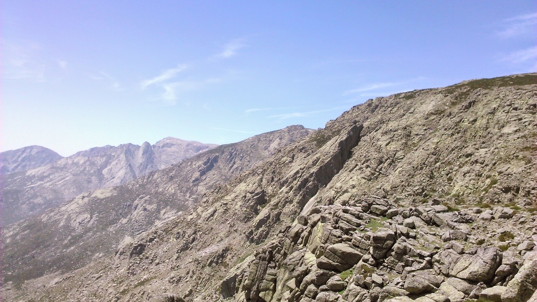
The actual path became better as I continued south-west, though there was a gruelling section from Puerto del Peón approaching one of the highest peaks, La Mira at 2,513 metres.
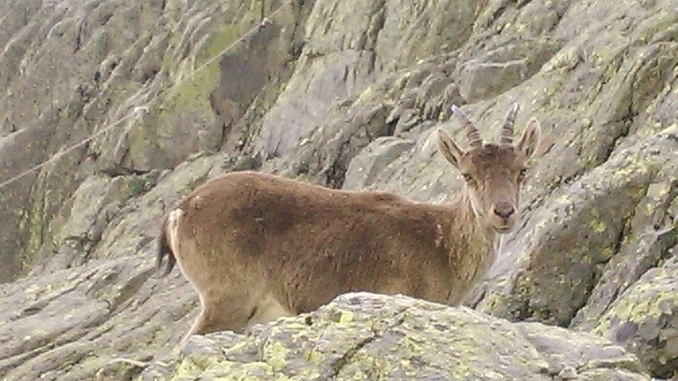
My path should begin just before then at the ruined Los Pelayos refuge. Wild ibex began to make an appearance, increasingly curious and tame, while the high, snowy peaks around the Circo de Gredos began to look less distant. When I eventually arrived there, I felt I was on the home run, though already late in the day.
It didn’t prove to be that simple.
It didn’t prove to be that simple.
The first problem was the cairns…they were everywhere. The route down to the Galayos gorge was incredibly steep, over boulder fields and I could see no clear path, except one miles below; just cairns in every direction. So I started clambering downward, looking for the climbers’ Victory Refuge where I assumed the good path would start and where I could fill my empty bottle. Progress was painfully slow, slithering down boulders, or even worse, stumbling on great mounds of turf, each giant tuft separated from the next by a plunging three-foot gap that my legs inevitably sank into. I was also becoming aware how potentially dangerous this environment is - not somewhere you would want to break a leg, especially on your own. After what seemed an endless effort, I arrived at the Refuge. Although closed, I could fill my bottle there and look for the path. Ibex hovered around and the majestic needles and pinnacles of los Galayos towered above. But it is hard to appreciate natural beauty when anxiety is your predominant emotion...
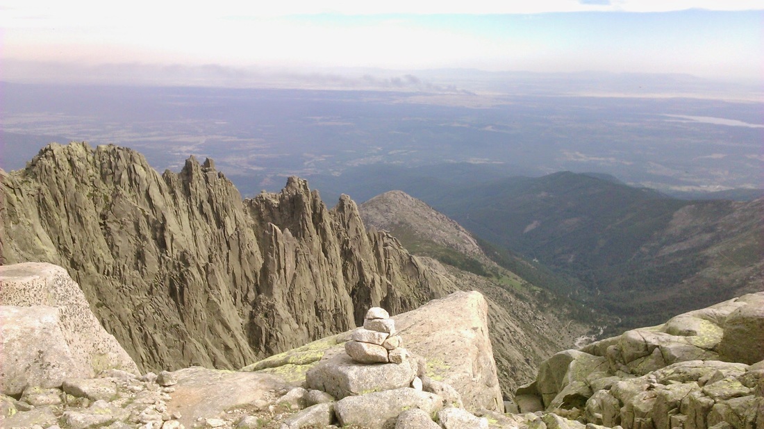
While looking for the start of the path, I spotted a couple of other people down to my left below the Galayos and assumed that that was where the path was, so I headed towards them. Unfortunately, they seemed to be ‘off piste’ and there was no path - just more boulders, gravel and slippery rocks to stumble, fall and slide though as my legs became more and more wobbly through the effort. Again, progress was painfully slow, but finally the proper path, when reached at about 8 o'clock was well-made. I came across the Spanish hikers I had seen before and asked them how far it was to go: I was horrified when they said at least another two hours!
Even worse, when setting off again as quickly as possibly, I turned my right ankle with a shriek of pain and an audible pop that I knew meant a ligament tear. I sat down for a few moments; for the first time I wondered if I really might not make it and might need to summon emergency help. However, trying the ankle again, I found that I could walk and continued down as fast as I could, but also desperately wanting to avoid the pain of another twist. I was able to make good progress, encouraged as I moved out of the bare rocks through the tree line and into the pine forest. In fact it didn’t seem too long before I finally got to the asphalt roadhead at Nogal del Barranco. Asking directions, a nice guy from Pamplona (where we had taught English for a year in the 1980s) gave me a lift to the unassuming but welcoming and cheap Hostal, saving a welcome few final kilometres as the evening light faded.
Even worse, when setting off again as quickly as possibly, I turned my right ankle with a shriek of pain and an audible pop that I knew meant a ligament tear. I sat down for a few moments; for the first time I wondered if I really might not make it and might need to summon emergency help. However, trying the ankle again, I found that I could walk and continued down as fast as I could, but also desperately wanting to avoid the pain of another twist. I was able to make good progress, encouraged as I moved out of the bare rocks through the tree line and into the pine forest. In fact it didn’t seem too long before I finally got to the asphalt roadhead at Nogal del Barranco. Asking directions, a nice guy from Pamplona (where we had taught English for a year in the 1980s) gave me a lift to the unassuming but welcoming and cheap Hostal, saving a welcome few final kilometres as the evening light faded.
Day four - on to Candeleda
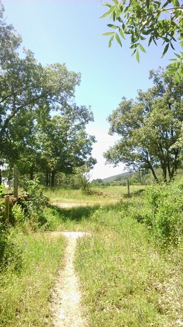
The next morning, my ankle was heavily swollen and bruised, but I was able to walk on it in reasonable comfort. My original plan for the day was to go back up the Galayos gorge, continue a westward traverse along the mountains and then down to the town by the Puerta de Candeleda. However, there was no way that I was going to go back up to the high mountains with a bad ankle, and in any case I think I finally realised the sense in the usual advice to avoid walking in potentially hazardous places alone. Instead, there was an alternative low level route to Candeleda through the pine forests, once again following the GR180 and so I set off
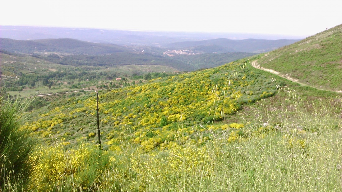
The way was mostly on tarmac and forestry track, which suited me and after quite a bit of twisting and winding, the way-marked route came out three hours later on the main road at Poyales del Hoyo where I treated myself to a coke and tortilla de patatas.
From there I was minded to take the direct route along the main C501 road to Candeleda rather than head back up to the foothills where the GR180 goes; however, soon after leaving Poyales, at a curious kind of sculpture park, another GR sign pointed to what turned out to be a pleasant off-road alternative route to Candeleda through fig orchards and woodland.
|

I stayed the night in the Hostal Pedros, where a bizarre, faded endorsement from John Major hung in the lobby after an apparently enjoyable stay with Norma in 1991. Times have changed a bit, but I suppose at 22 Euros it’s hard to complain. |
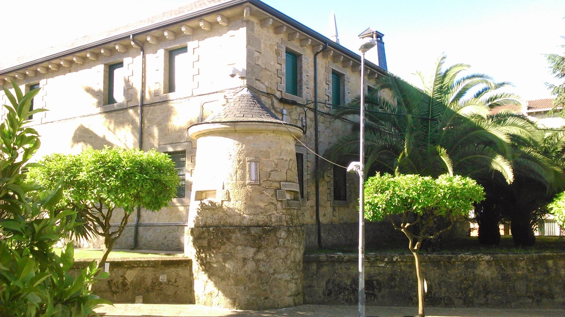
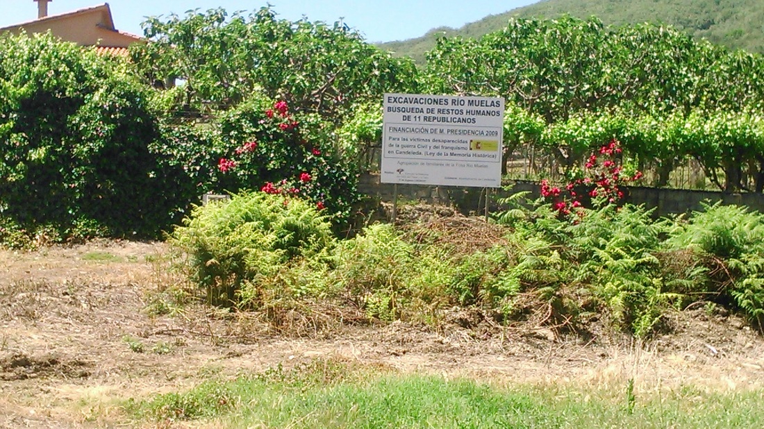
This is the nearest town to the finca that I had stayed in before and has a well-preserved old quarter, including a ‘Juderia’. However, the only building that I remembered well from the previous visit was the police station with a classic Franco-era fascist turret. Another civil war reminder had been provided by a touching roadside sign marking a search for the human remains of eleven republicans who had disappeared in the war on the way at the Rio Muelas.
|
|
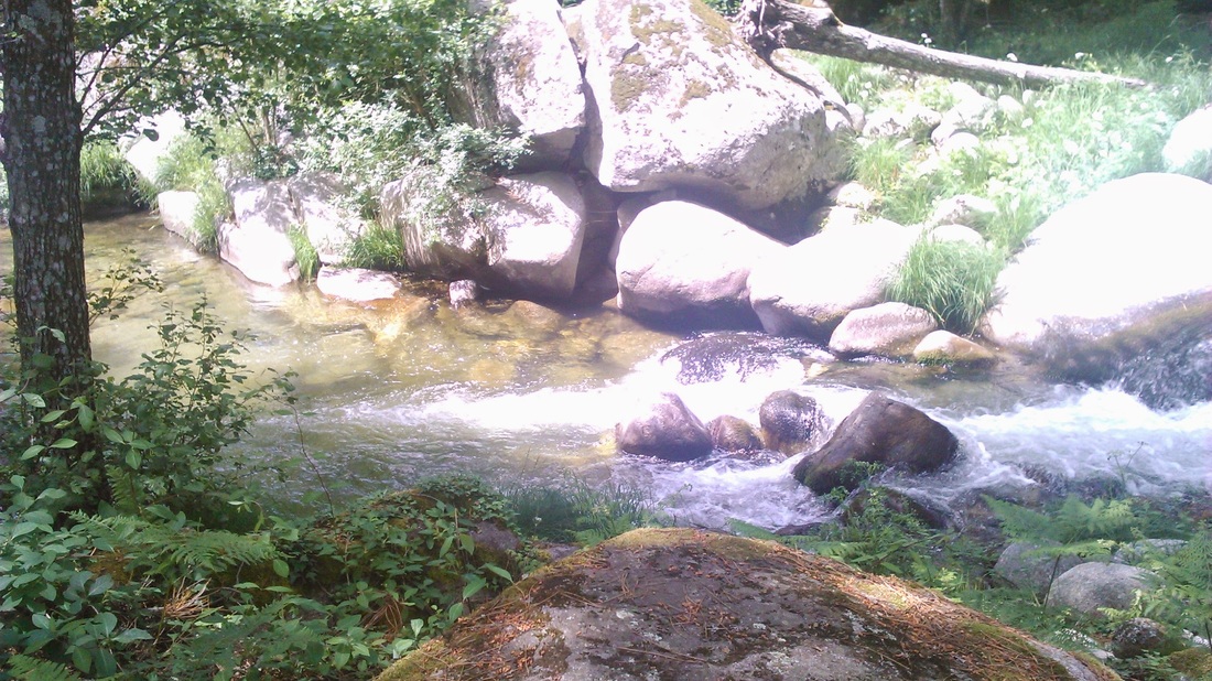
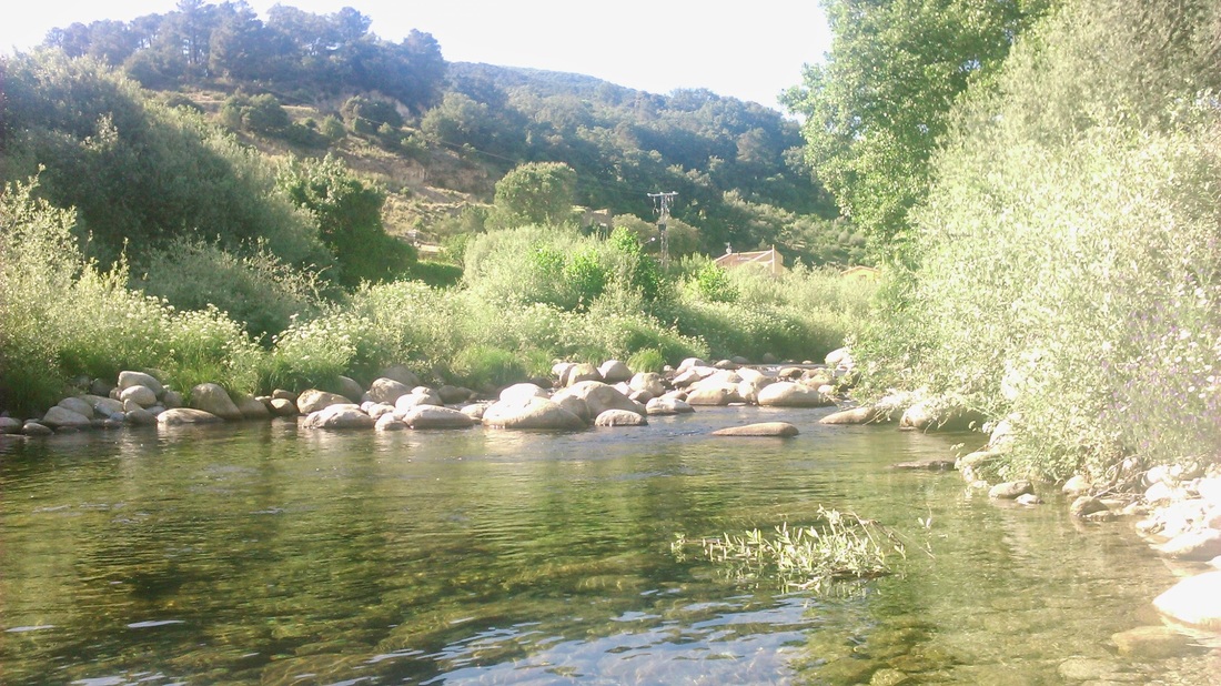
I arrived reasonably early, so had time to sit for an hour or two in the warm evening sunshine in the river that cascades down from the mountain (‘garganta’) with a cold litre bottle of San Miguel and a book, soaking my ankle in the mountain water.
Day five - on to Madrigal via Santuario Virgen de Chilla
My final day continued along the southern foot of the mountains to the next small town, Madrigal de la Vera about 12km to the west. The route, still fowling the GR180 went up the slopes to the Sanctuary of the Virgin de Chilla, and should pass the Prado Lobera finca where I had stayed in before. This road was now fully tarmacked, having been a dusty dirt track thirty years ago.
The beautiful countryside was mixed oak woods (full of busy jays), gardens, orchards and flowery meadows. The slight gain in altitude produced more views of the Tiétar valley, its full reservoirs shining in the sun after a wet winter.
I had thought the finca was off to the left but couldn’t recognise it. Nearing the top, I met a man going for a Saturday walk with his kids and asked him if he knew it; he did and gave me a detailed but fast explanation; all I could really understand was that it was on the other side of the road and something about retired English owners. Not to worry.
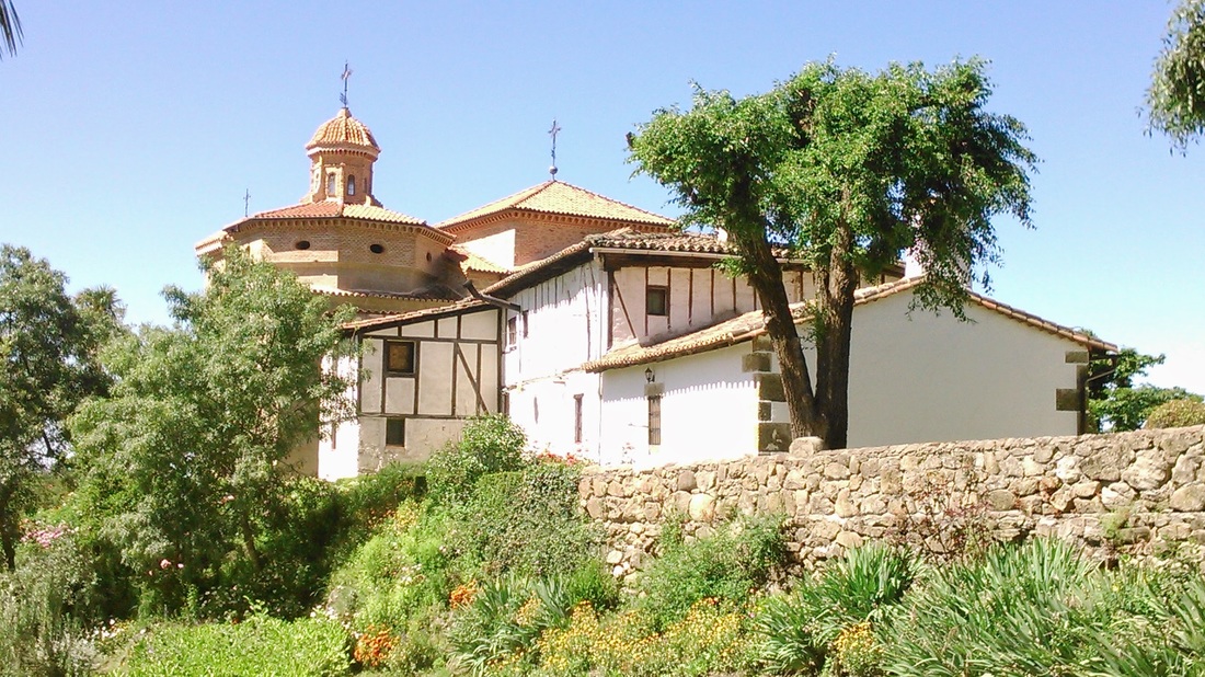
After 5km, the sanctuary came into sight, nestling in a lovely spot in a small garganta valley. Supposedly the sight of a miraculous appearance of the virgin, the church has some mediocre paintings of the event, although the neighbouring building are older and quainter.
After 5km, the sanctuary came into sight, nestling in a lovely spot in a small garganta valley. Supposedly the sight of a miraculous appearance of the virgin, the church has some mediocre paintings of the event, although the neighbouring building are older and quainter.
|
|
From there, the route winds down in more open countryside down through the small village of El Raso towards Madrigal. I skipped the section up to the main local sight - the sparse ruins of a pre-Roman Celtic settlement - and headed down to the town.
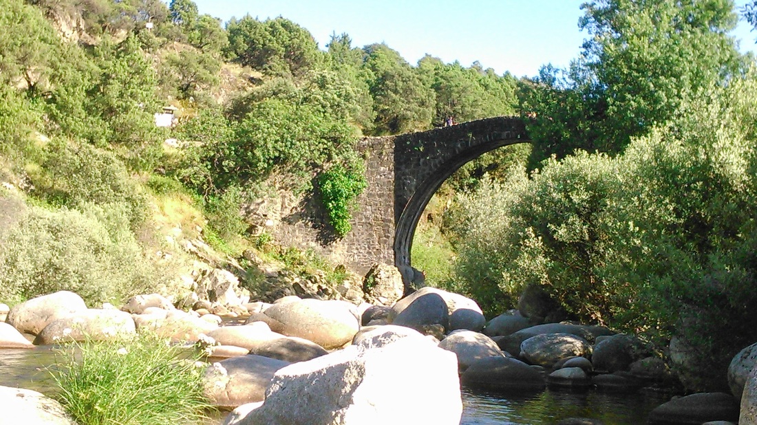
This meant unfortunately that I arrived in town through the modern bridge, a kilometre from the town on the main road, rather than the GR route which arrives over an ancient bridge just upstream. Known locally as the Roman Bridge, it doesn’t look in the least Roman to me, and doesn’t even have straight approach roads. However, it was another nice spot to sit in a mountain stream with a cold beer and book.
|
|
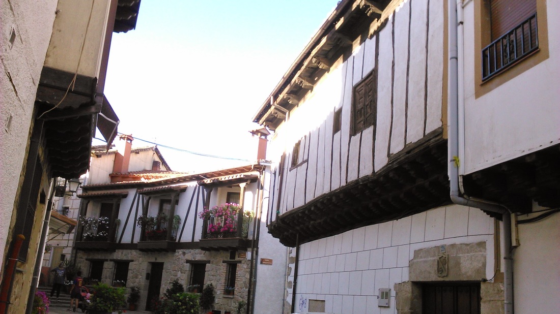
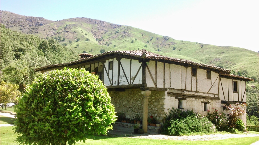
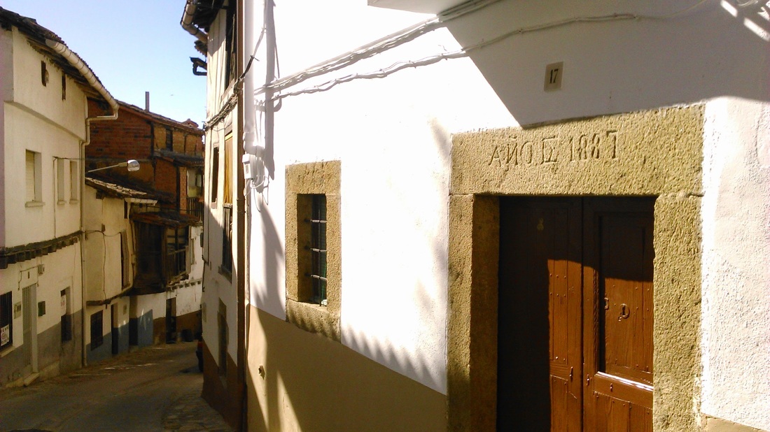
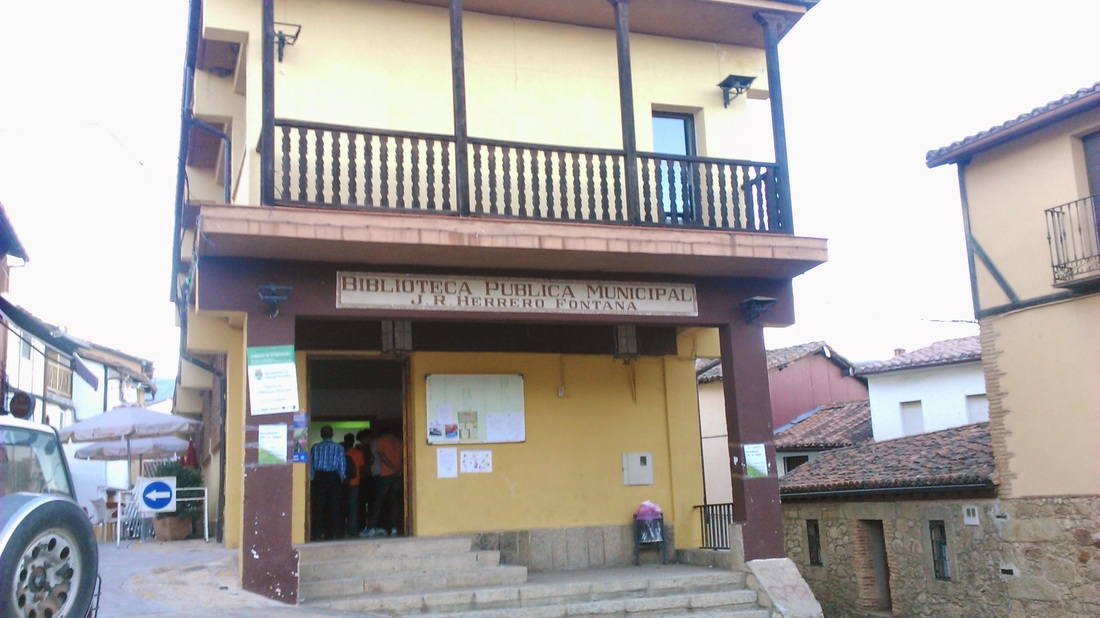
The town itself has another old quarter, with half-timbered houses and wooden balconies. However, like other other towns in the area, many of the buildings are not as old as they appear at first sight, with several ancient-looking houses having lintels carved with 19th century dates. Fairly primitive architectural techniques seem to have lasted a long time in these parts. Like the first village I visited, El Arenal, it has a range of facilities including a public library that you wouldn’t find British settlements of the same size.
|
|
So that was the end of my hiking. The signage for the long distance routes (GR10 and GR180) was much better than I had expected and I had got to see both sides of the range, and the tops as planned. I had also maybe learnt to know my limits a bit better and might even follow Matthew’s advice next time and have a few more nice lunches.