Bologna to Florence: Via degli Dei
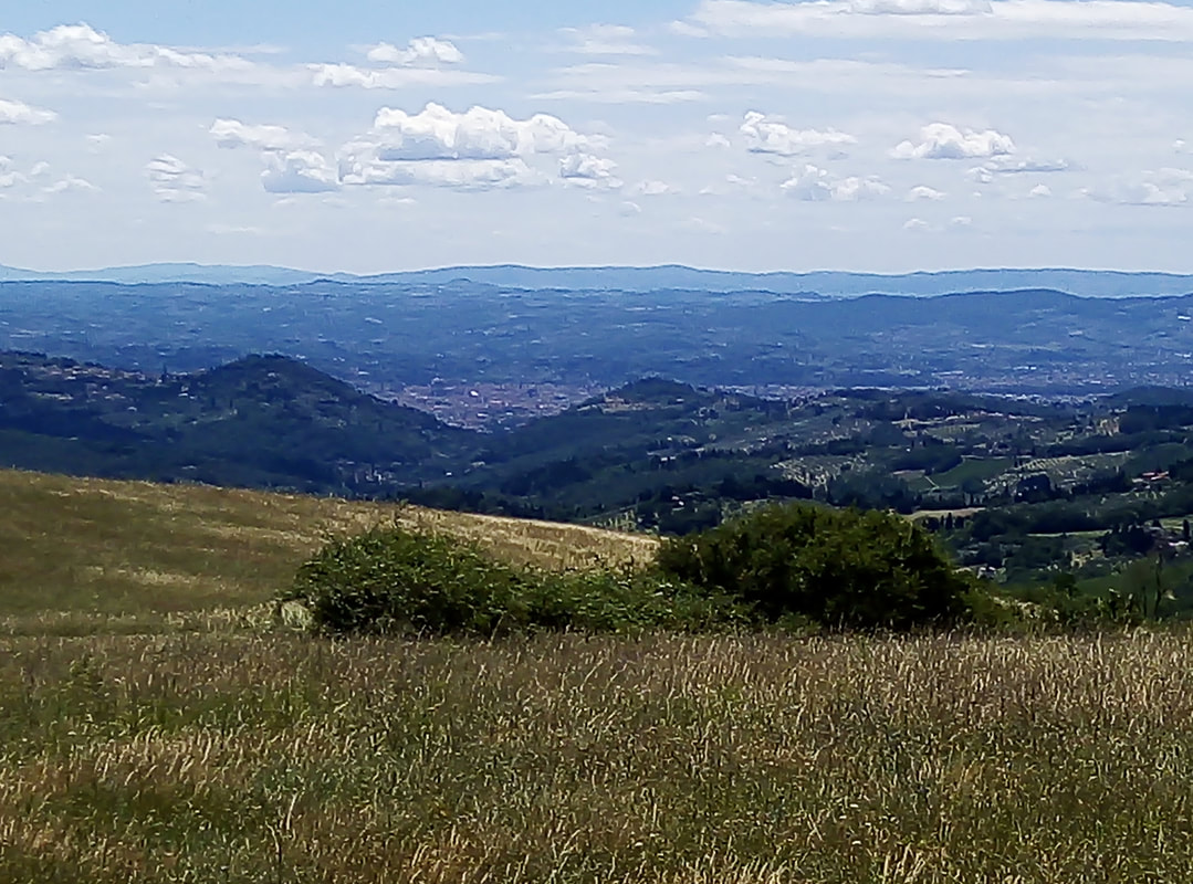
On the Tuscany side...
This was my first walk for a couple of years, mainly because I’ve had persistent problem with torn ankle ligaments. But with six months since the last incident and lockdown rules lifted, I was keen to see if I could manage a decent, moderate walk. After a bit of research, I discovered the so-called Via deli Dei (“Way of the Gods”) between Bologna and Florence across the Appenines, supposedly following the route of the Via Flaminia Roman road. I like a bit of Roman road so arrived in Bologna in mid July…
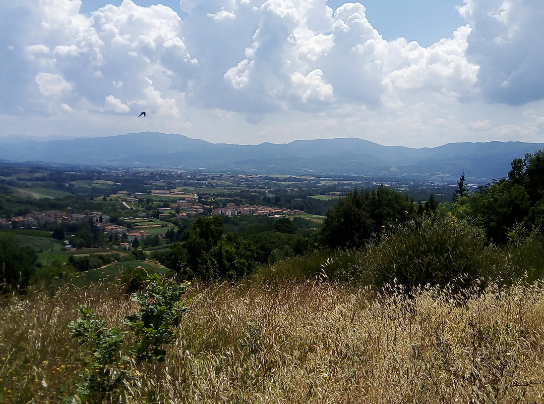
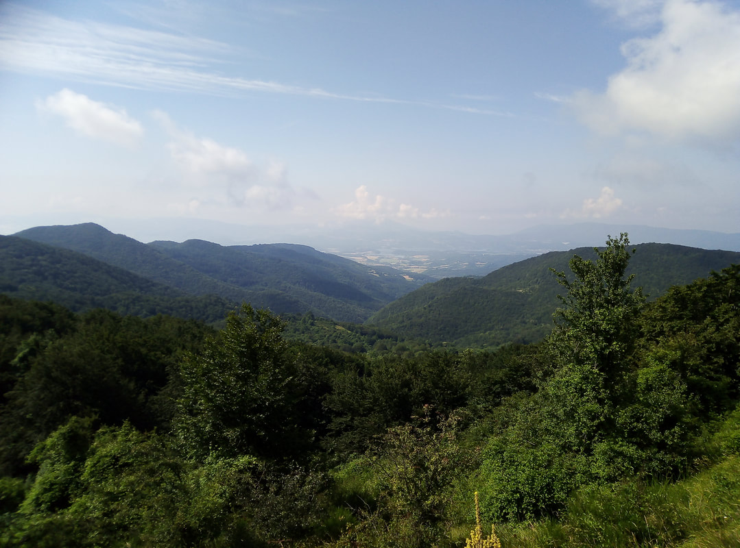
View to the east
Day 1 Monzuno to Madonna dell Fornelli
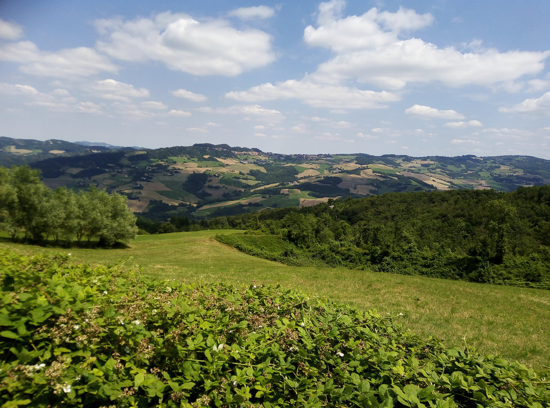
I skipped the first stages, catching the train from Bologna to Sasso Marconi and then a connecting minibus to Monzuno arriving at lunchtime. This was because I wanted to have a couple of free days during my week away and also because, thanks to this blog xxx I’d read that the route in a lot of the first sections follows a lot of tarmac - especially up to Monzuno. On arrival, I was surprised to see dozens of hikers with backpacks - the first indication of just how popular this route turned out to be. As for the walking, this was a gentle introduction, about 3 hours to Madonna dei Fornelli, mostly on paths through the woods along the crest of the ridges. Initially there are fine views east over the Savena valley to Loiano. pic. A little later, the views open out to the west over the Setta valley to the higher Appenine peaks in the distance like Corno alle Scale. Unfortunately, most of the actual peaks (only around 1000 metres high) are occupied by communications installations so you don’t always get the views you might expect. After a fair bit of crunching along a final section of ‘white road’, I arrived in Madonna dei Fornelli in time for a cold early evening beer. I stayed at Albergo Poli - lovely, cheerful (and cheap) place; recommended!
I skipped the first stages, catching the train from Bologna to Sasso Marconi and then a connecting minibus to Monzuno arriving at lunchtime. This was because I wanted to have a couple of free days during my week away and also because, thanks to this blog xxx I’d read that the route in a lot of the first sections follows a lot of tarmac - especially up to Monzuno. On arrival, I was surprised to see dozens of hikers with backpacks - the first indication of just how popular this route turned out to be. As for the walking, this was a gentle introduction, about 3 hours to Madonna dei Fornelli, mostly on paths through the woods along the crest of the ridges. Initially there are fine views east over the Savena valley to Loiano. pic. A little later, the views open out to the west over the Setta valley to the higher Appenine peaks in the distance like Corno alle Scale. Unfortunately, most of the actual peaks (only around 1000 metres high) are occupied by communications installations so you don’t always get the views you might expect. After a fair bit of crunching along a final section of ‘white road’, I arrived in Madonna dei Fornelli in time for a cold early evening beer. I stayed at Albergo Poli - lovely, cheerful (and cheap) place; recommended!
 View to the west
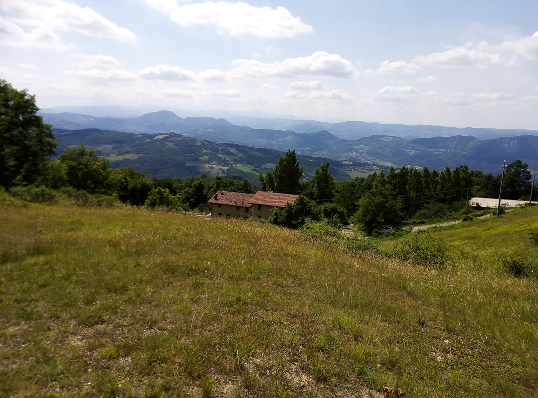
Day 2 Madonna dei Fornelli to Paso de la Futa
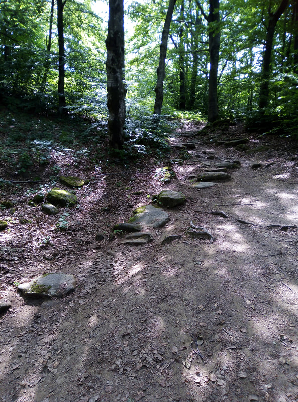
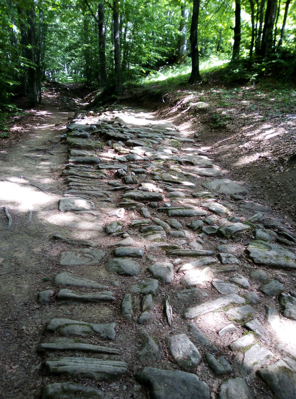
The first full day started with a steady climb, with the path staying over 1000m almost all day, staying as usual close to the crest, mostly in forest with occasional high meadows. The first glimpse of what felt like an ancient route came after an hour or so. A few km later, several signs pointed to the ‘strada romana’ and sure enough, the path ran beside a short section of paved Roman road. As this is only about 50 metres long, I’m not sure it is worth a special effort to visit. Later in the day, descending to Paso de la Futa, there are some other sections of Roman paving. I believe that the best preserved sections are south of the Paso, towards Monti di Fo, which I didn’t visit.
The first full day started with a steady climb, with the path staying over 1000m almost all day, staying as usual close to the crest, mostly in forest with occasional high meadows. The first glimpse of what felt like an ancient route came after an hour or so. A few km later, several signs pointed to the ‘strada romana’ and sure enough, the path ran beside a short section of paved Roman road. As this is only about 50 metres long, I’m not sure it is worth a special effort to visit. Later in the day, descending to Paso de la Futa, there are some other sections of Roman paving. I believe that the best preserved sections are south of the Paso, towards Monti di Fo, which I didn’t visit.
Old track
|
Roman road
|
After the peak of Le Banditacce, the highest point on the whole route at 1200m, a long descent though the woods suddenly emerged at the road opposite the German war cemetery. This is beautifully designed and maintained, simple and poignant and well worth a visit with each stone representing two soldiers, many of course “unknown”. We are now in Tuscany. Overnight at the Camping de la Futa, well equipped especially for kids, though at 900 metres above sea level, I’m not sure how often the pool will get used. It was pretty cold, especially when some early evening rain arrived.
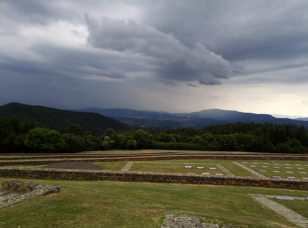
German war cemetery
Day 3 Paso de la Futa to San Piero a Sieve
The first section from the roundabouts near the campsite is a long ascent of the ridge leading to the peak of Monte Gazzaro, rising and falling along the crest through thick woods. Just before the peak is a ruined shelter with a visitor book (which I signed). Also here were signs saying that the path over and down the peak is dangerous and closed. However, accounts of the route which i had read, including the official guide, say the route is passable with care, the weather was good, and I don’t always obey signs, so…I thought I’d give it a go. In fact it was fine, though steep, with hand rails at the trickiest places. Definitely not to be attempted in wet weather though.
The first section from the roundabouts near the campsite is a long ascent of the ridge leading to the peak of Monte Gazzaro, rising and falling along the crest through thick woods. Just before the peak is a ruined shelter with a visitor book (which I signed). Also here were signs saying that the path over and down the peak is dangerous and closed. However, accounts of the route which i had read, including the official guide, say the route is passable with care, the weather was good, and I don’t always obey signs, so…I thought I’d give it a go. In fact it was fine, though steep, with hand rails at the trickiest places. Definitely not to be attempted in wet weather though.
On the way to Gazzaro (1)
|
On the way to Gazarro (2)
|
After the descent - which is probably no more than 100 metres in height - a rather overgrown, and clearly much less-used grassy section of path follows the crest between two valleys with views to both north and south. A spectacular view of the Mugello area really opened up, with the lake of Bilancino (near my destination) glinting in the distance. After reaching the major junction of the Osteria Bruciata, the path becomes a wide track ploughing through beech forest gradually winding and descending for a good three hours.
On the way to Paso Osteria Bruciata
All of a sudden, a house appears on the left - the first sign of settlement since Paso de la Futa - and, ignoring a ‘Private Road’ sign, fields! A strange sight having been in the woods and wilds all day. Sant Agata is nearby and I stopped for a quick drink there with a group of hikers that had passed me earlier in the day and visited the very old church. They were the only people I saw all day - this part of the route was far less busy than previous sections. On the map, the final section to San Pietro looked short - but it is another 7km slog along mostly asphalt minor road - really not very appealing at the end of a long day.
as staying at the Mugello Verde campsite (massive, industrial scale, but with surprisingly good restaurant and big pool). To arrive there, I confidently followed the route on the map, taking the path below the castle to arrive at the campsite - at a locked gate at the top. The entrance is on the other (northern) side - another 2km some along busy roads…:-(
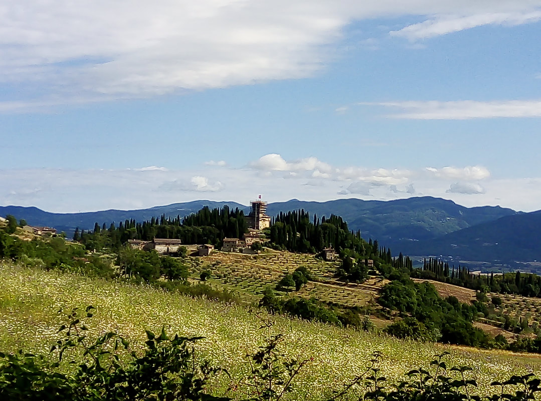
Medici Villa at Trebbio
I took a rest day, mainly because of thunderstorms, visiting the Bosco ai Frati convent a few km away. Having made no navigating errors so far (the Via deli Dei is very well way marked) I managed to get lost following a diversion route of the Via on the way back. This meant I was caught in the storm and entangled in increasingly impenetrable woods before accepting I had to retrace my steps. Legacy being that my map was soaked and in shreds.
Back on the main track the following day, is a long but varied section to Fiesole, starting back at the gate at the top of the campsite which you can exit from, leaving the key in a secure box. First point of note is the Medici villa at Trebbio, privately owned, under restoration and not possible to visit, but scarcely looking 600 years old. The path meanders up and down through farm land and woods, before climbing again towards the abandoned abbey of Buonsollazzo. I had one uncomfortable encounter with 20+ guys on mountain bikes crashing through the narrow path towards and past me - the Via is popular on bike as well as on foot.
Despite having descended from the Appenines to the relatively low land (200m asl) around San Piero, there are several climbs back up to 700m or more still to come. On one such peak is the amazing convent fortress of Monte Senario. With time pressing, I didn’t stop longer than to take an expresso, but it would be well worth a proper visit another time.
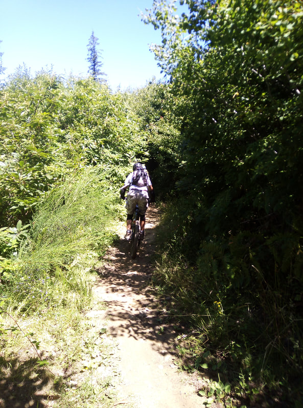
Bike alert!
|
Monte Senario
|
After descending again through more farmland, Florence came into view for the first time, shimmering at the bottom of the Arno valley, the dome of the Duomo unmistakable. There’s one final climb up the oak-covered peak of Il Pratone. The final descent follows briefly some ancient (but not, I think Roman?) paved road before joining more asphalt leading to Fiesole. My hotel for the night was a little outside central Florence, so after a quick beer, I was happy to finish by forking out 25 Euro for a taxi.
Florence comes into view...
Reflections…
This is really an easy walk, very well signed and maintained, with plenty of overnight stops, bars, restaurants on the way (except for the wild section from Paso de la Futa to Sant Agata). You can’t get lost! There are lots of grand, though rarely spectacular views as the highest point is 1200m (much less than Ben Nevis!). The paths themselves are mostly pretty good, though at times there’s too much road. The Roman associations seemed overhyped to me, with sightseeing highlights the German war cemetery and Monte Senario. Although doing this in mid-July, the weather was fine - probably a little cooler than average for the time of the year, less than 30 degrees, and with one typical Italian summer storm. The thing that surprised me most was how popular the path is - especially on the Bologna side. Every hiker I met was Italian - foreign visitors being very few and far between with the lockdown only recently lifted - so in a ‘normal’ year, I would imagine it is really busy.
The whole route is 130km, but by cheating at each end, I probably did only about 90 km all told. This worked out well, with each day being longer than the last and I managed to finish before 6pm each day (well before at Paso de la Futa). No ankle problems! The 10 Euro map (1:25,000: my favourite scale!) is excellent (though not waterproof as I discovered!) and easy to find in tourist offices, bookshops etc.
http://www.viadeglidei.it/?lang=en
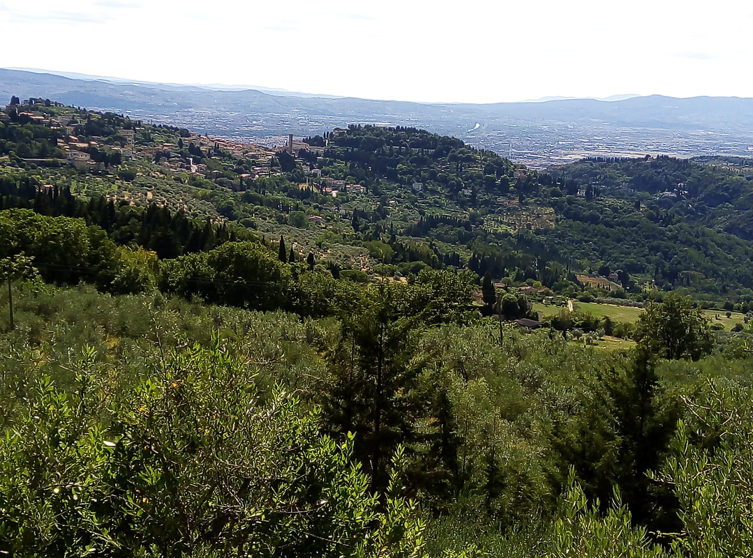
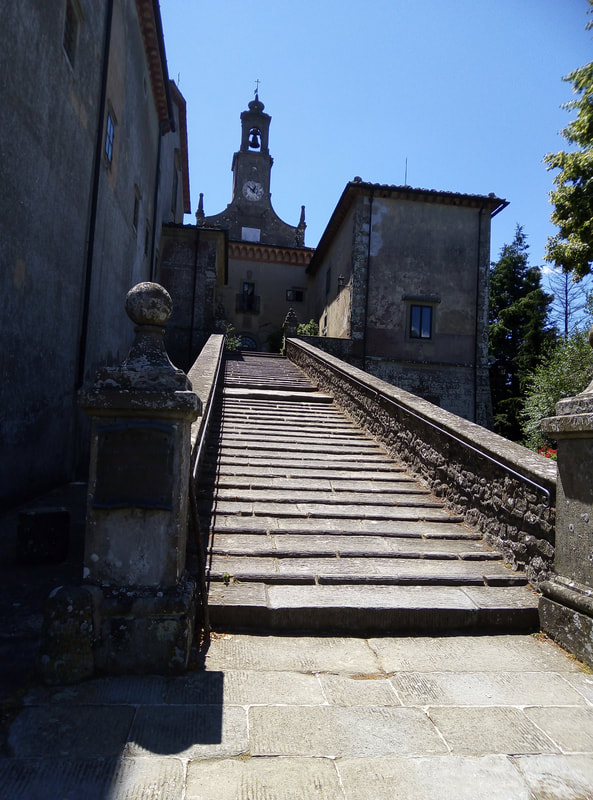
Fiesole
