Tenerife - ‘over the top’
|
The Canary Islands are appealing for walkability and decent hotels all year round and I had been minded to do this walk for quite a while. The idea was to walk pretty much south to north over the island, from Vilaflor to Puerto de la Cruz in just two or three days in early December 2016. Technically, I was never planning to go right ‘over the top’ - i.e. the peak of Teide at 3718 metres, the highest mountain in all of Spain - but over the cañadas, the volcanic caldera which is over 2000 metres above sea level, and then down the supposedly green north coast. For maps, I had a ‘Brawn’ map of Tenerife walks and a rather nice 1:25,000 Spanish map of the national park (the centre of the island).
|
Day one: around Vilaflor
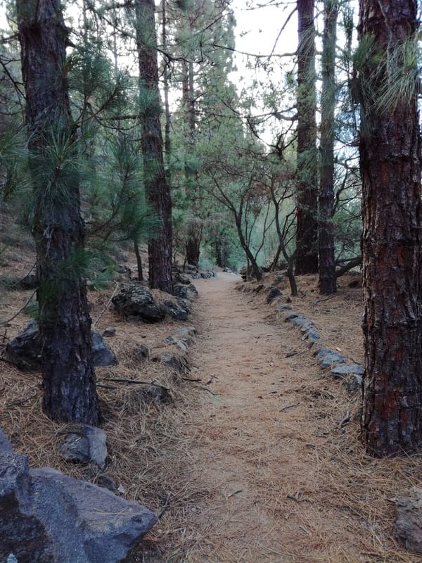
With an early flight arriving at lunchtime, I had considered if it was possible to walk from TFS airport all the way up to Vilaflor, high in the southern pine forests at around 1500 metres. I decided that it wasn’t and took a taxi instead (just over half an hour); bus links also looked uncertain. This was a wise choice as it looked like it would have been very difficult and unpleasant to try to navigate the industrial/commercial lowlands above the airport on foot. It also gave me the chance for an afternoon walk in the pine forests after checking into the rather lovely Hotel Villalba (bathrooms bigger than some hotel bedrooms I’ve stayed in!).
|
|
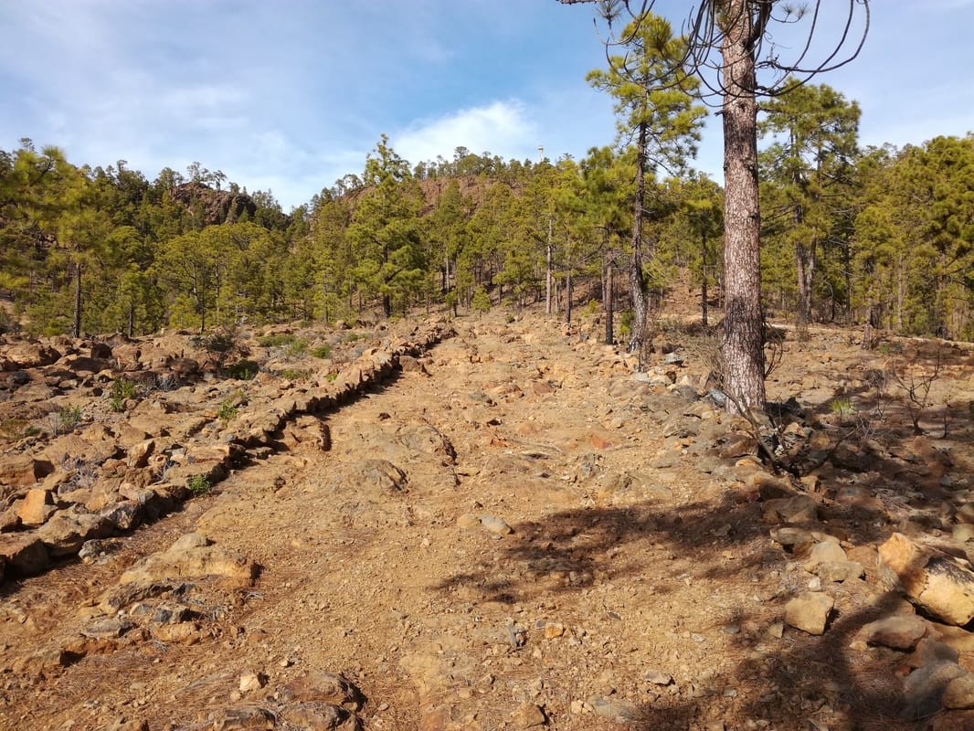
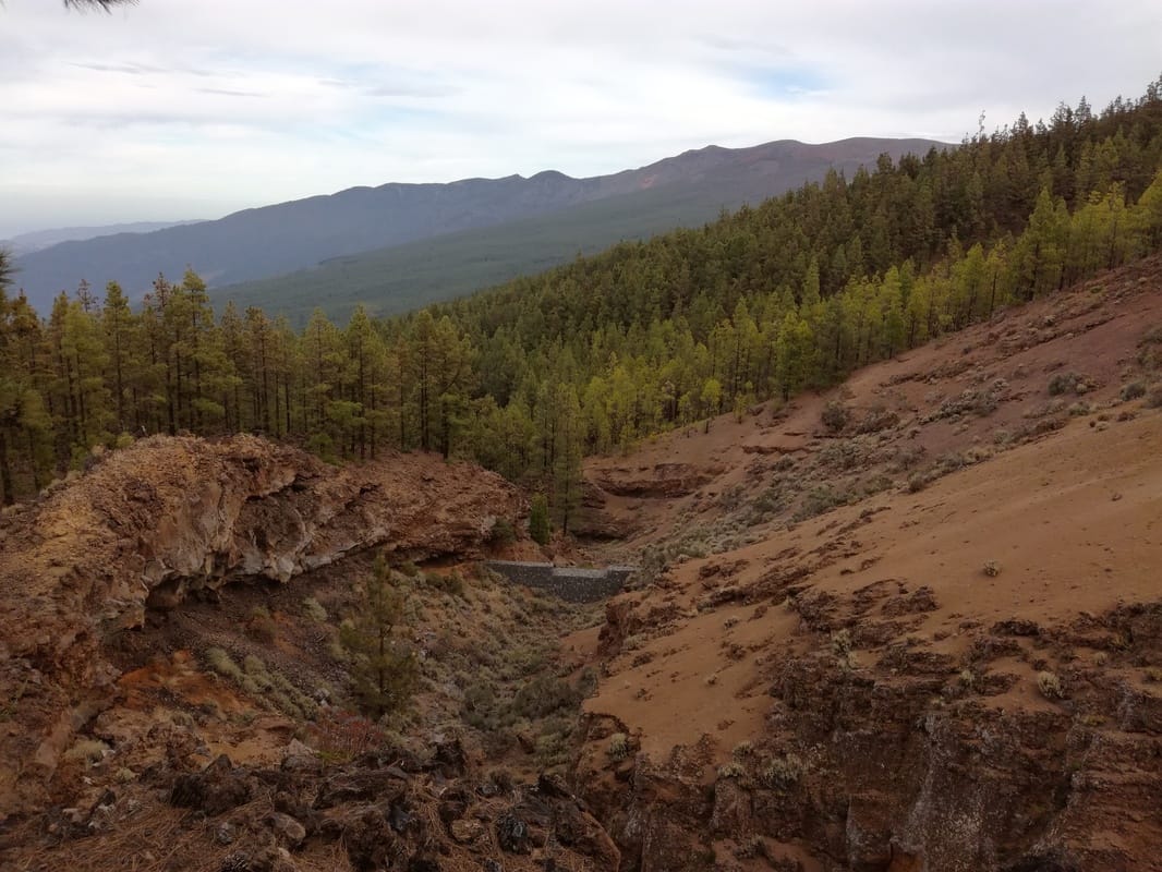
This involved a loop of about 8km up to just over 1800 metres along mostly good wide tracks that I assume are fairly recent construction. However, at the head of the Barranco de la Magdalena, a landslip had obliterated the path on both sides so some scrambling was required. Worse were short sections of steep path on the other side covered in slippery pine needles which needed careful attention. Needless to say, the views south were striking - the airport, lowland towns and greenhouses far below.
Day 2: into the Cañadas
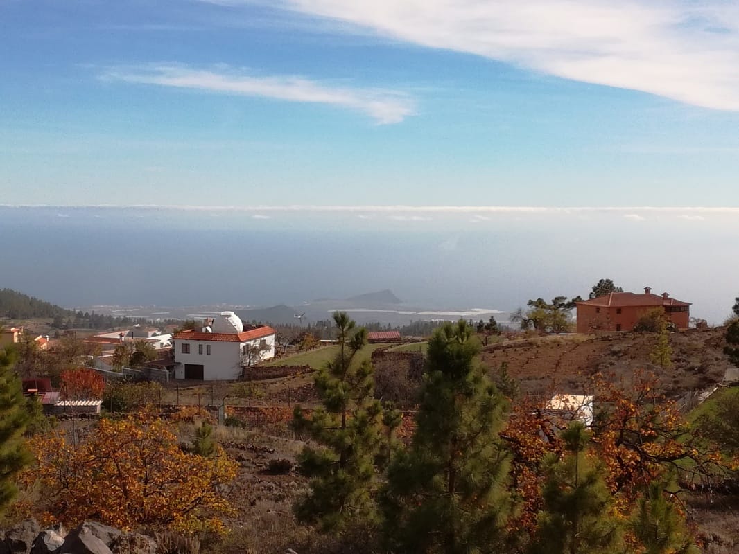
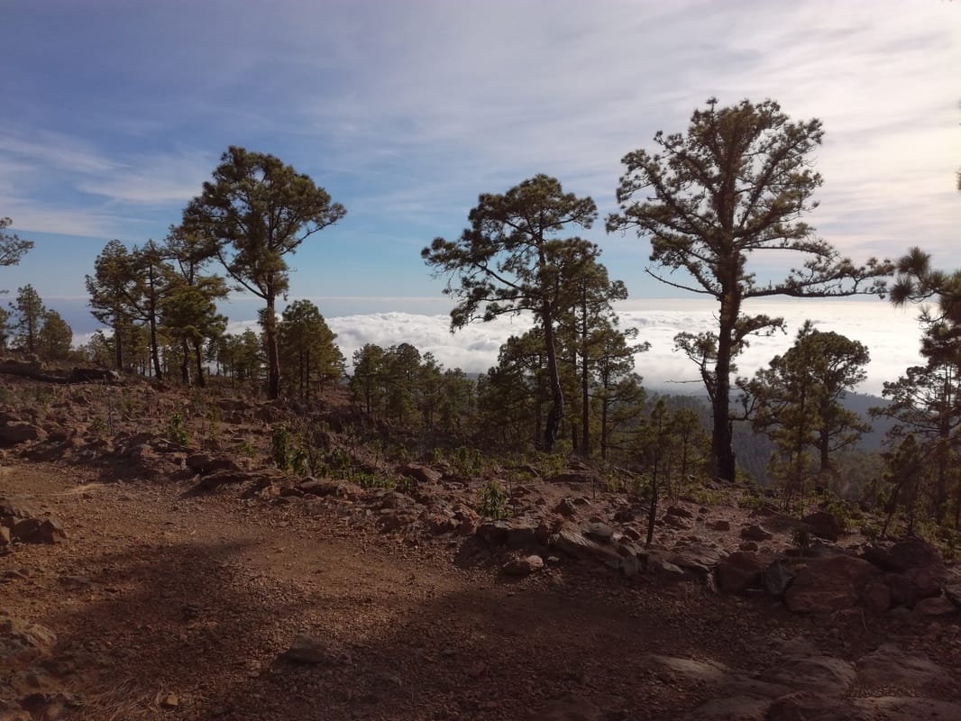
The object of this day was to get to the parador in the caldera - the only place to stay in the national park that covers most of central Tenerife. I was intending to look at the paisaje lunar (lunar landscape) on the way, and then up through the pass (degollada) of Ucanca and down to the parador in the cañadas. I hadn’t realised that my route basically followed a well-maintained trail, the GR131, which is way-marked with red and white marks and posts, French-style. So navigation was really not a problem (indeed you probably don’t even need a map at all to follow this route). Leaving the terraced cultivated land east of Vilaflor, the path soon climbed up into the very pleasant pine forests. It is very clear, well marked and designed to keep out bikes, horses and vehicles.
|
|
The signage points to Guajara, one of the main peaks on the caldera rim, and also to the
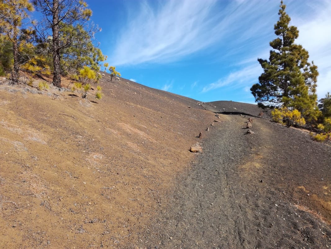
paisaje lunar. After missing the direct route to the Ucanca pass, I decided that I would climb Guajara instead (2,715 metres), and settled for a long distance view of the paisaje lunar, rather than detour to see it close-up. Eventually, at close to 2000 metres, the forests began to give way to gravel, rock and ash. One long section was particularly gruelling as it climbed steeply step after step over black cinders in a ruler-straight line. After more rocky sections, the path eventually reaches the pass where the path to the summit of Guajara - still another 3-400 metres up - is signalled.
paisaje lunar. After missing the direct route to the Ucanca pass, I decided that I would climb Guajara instead (2,715 metres), and settled for a long distance view of the paisaje lunar, rather than detour to see it close-up. Eventually, at close to 2000 metres, the forests began to give way to gravel, rock and ash. One long section was particularly gruelling as it climbed steeply step after step over black cinders in a ruler-straight line. After more rocky sections, the path eventually reaches the pass where the path to the summit of Guajara - still another 3-400 metres up - is signalled.
|
|
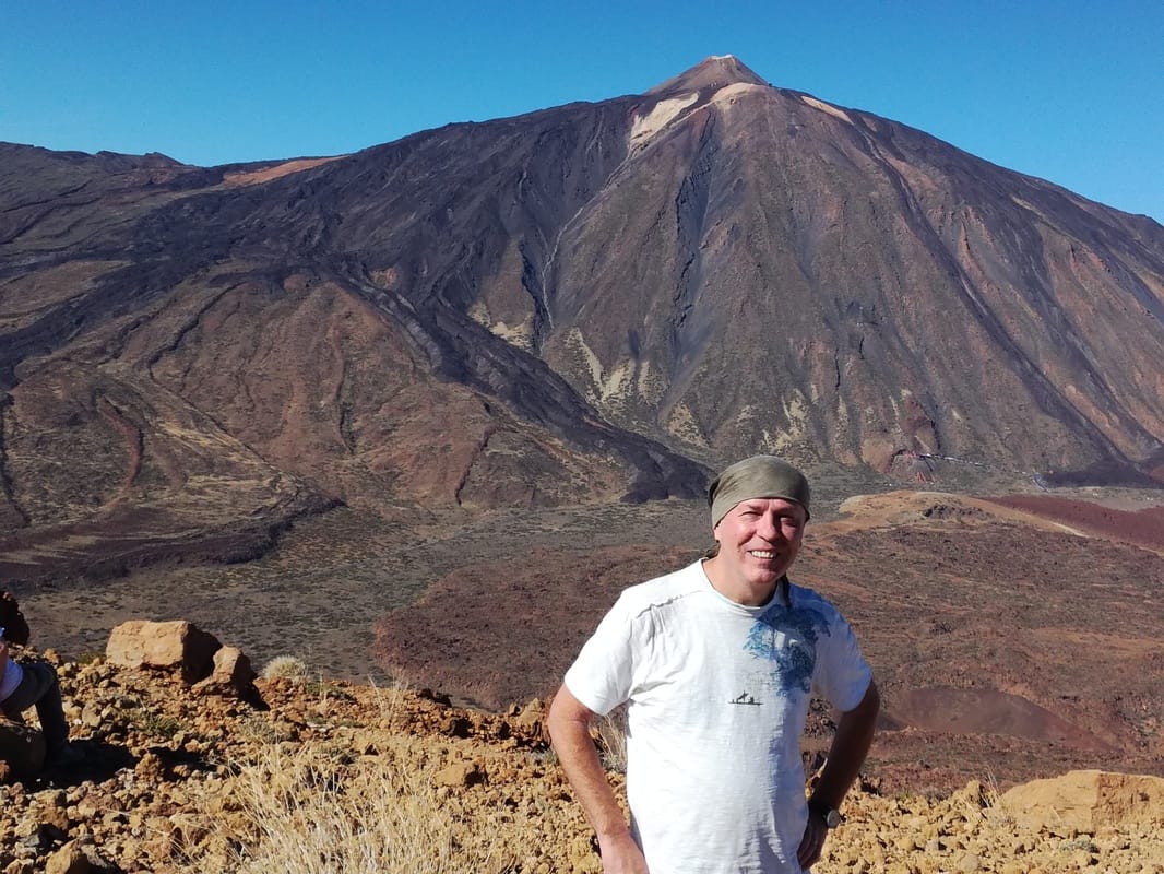
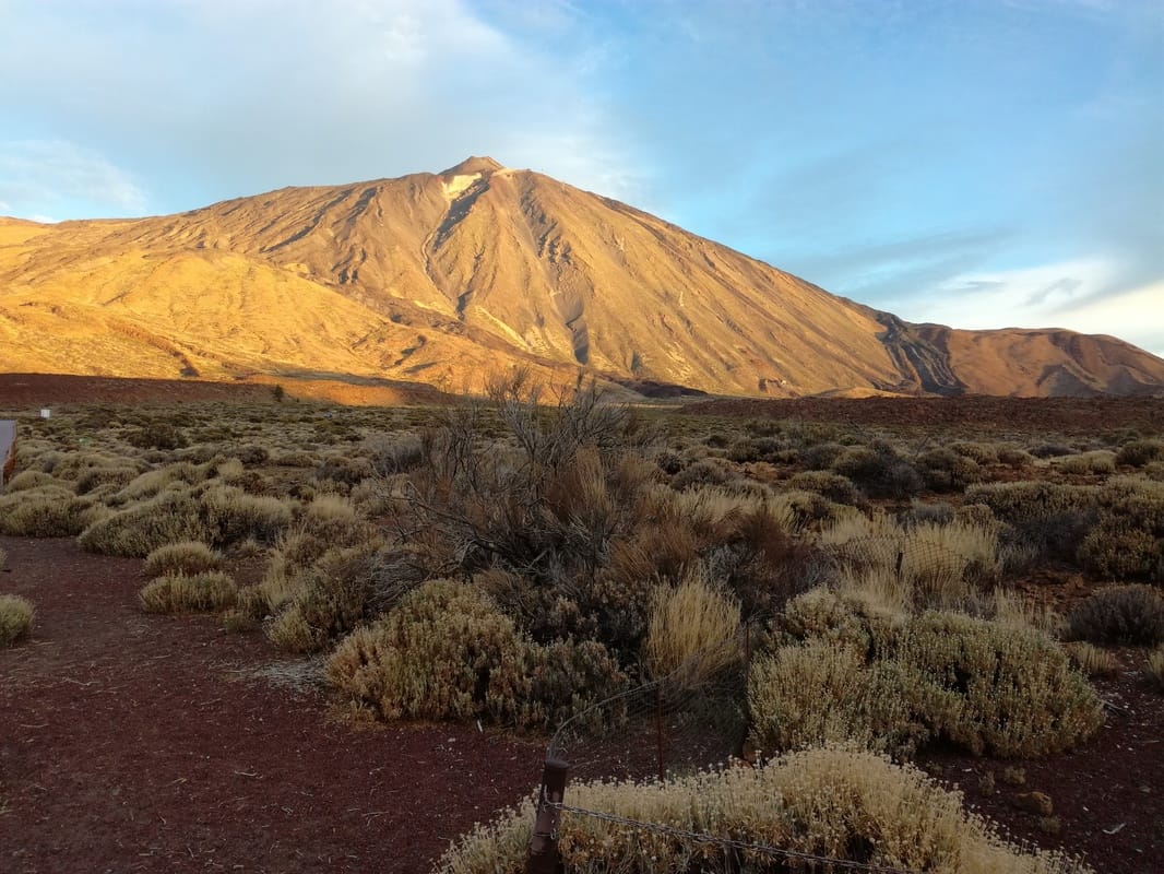
This was very slow going for me and began to feel brutal (it is close to 9,000 feet in altitude) but over an hour later the flattish summit was suddenly reached. Right before you was suddenly the massive presence of Teide, rising nearly another 1000 metres above the Guajara summit and looking rather like a crude, gaudy painting on the sky.
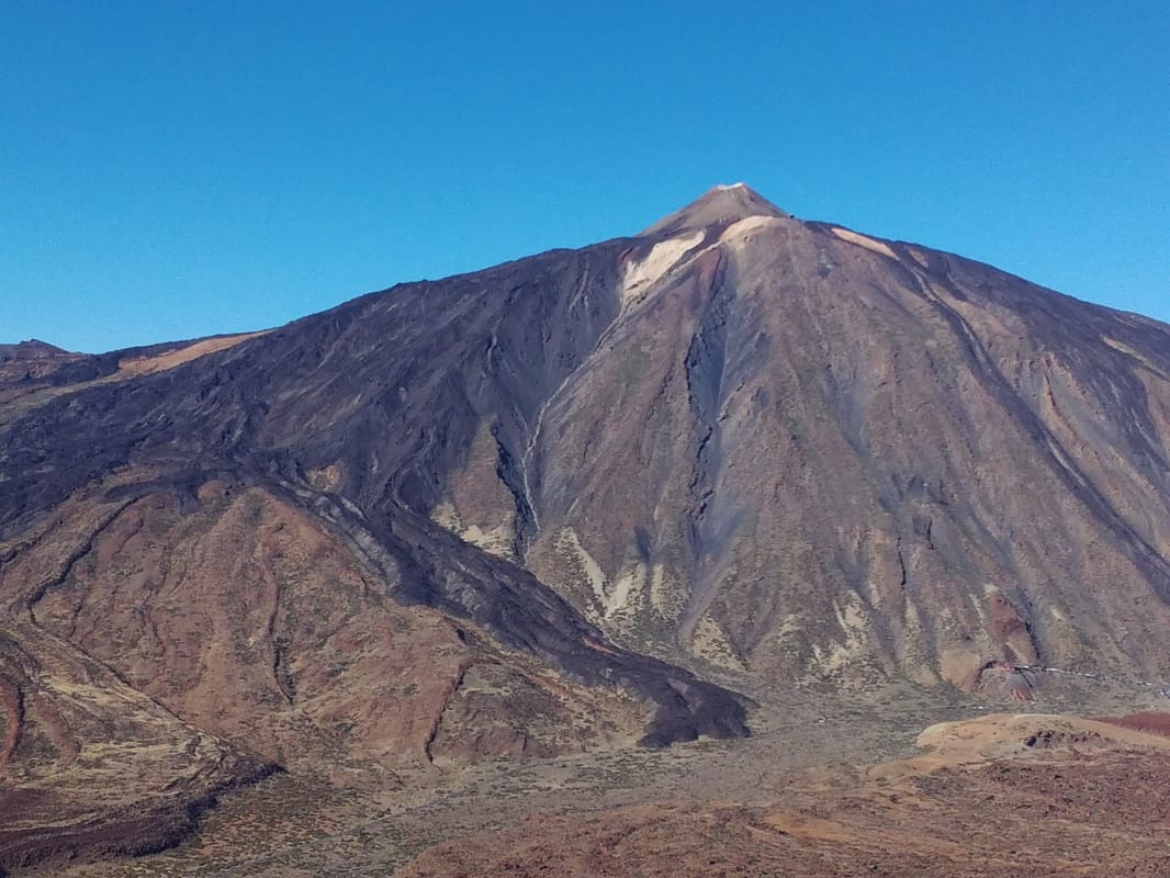
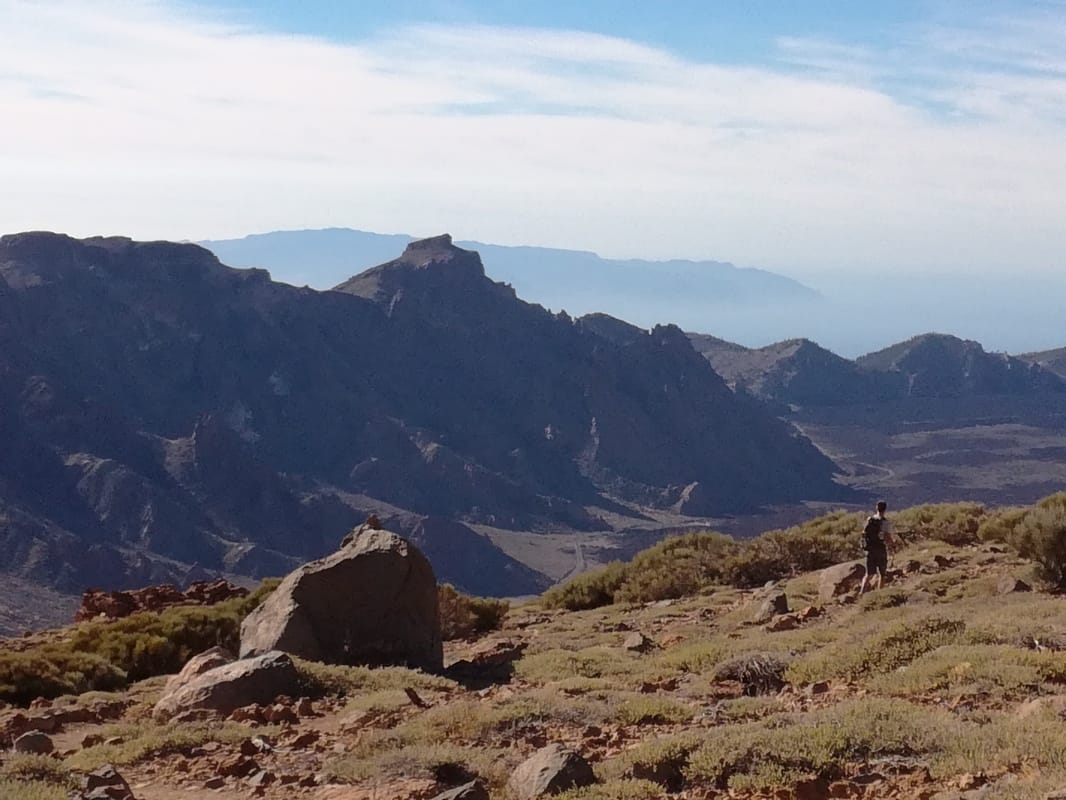
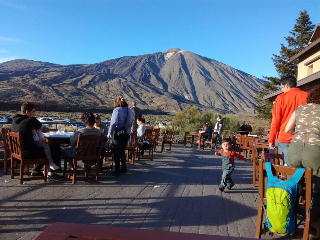
The summit of Guajara was quite busy - I had encountered several walkers throughout the route - and many more people evidently climb Guajara having parked at the parador for a day trip. La Gomera and La Palma rose through the coulds across the sea. I followed the trail (new, I think and not the one marked on my maps) down from the summit to the pass on the west, with a German guy Martin and eventually onto the parador. The parador is not one of the best, heaving with day visitors, but there is no doubting the view from the terrace is spectacular.
Day 3: On to El Portillo and La Orotava
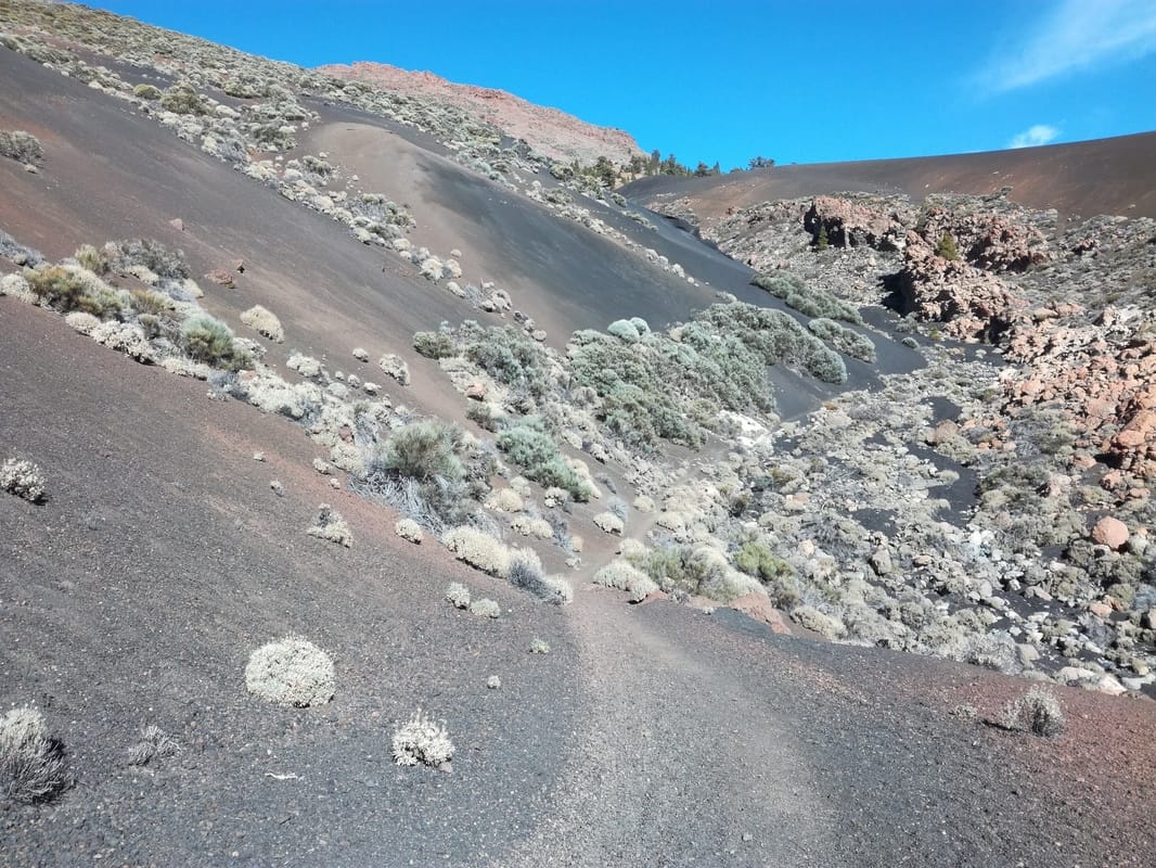
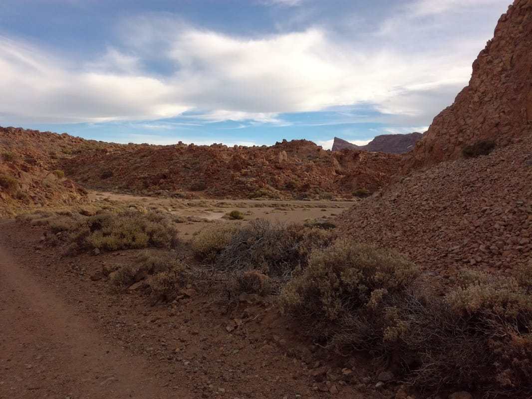
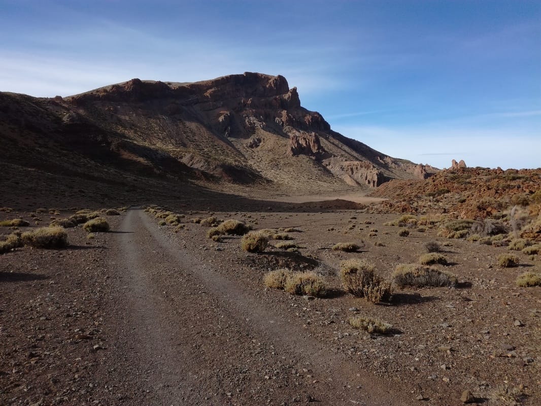
My plan was to walk to the other end of the caldera to El Portillo, where the single daily bus left around 4.30 down to la Orotava. The morning route was fast walking all along a level dirt track - again, no possibility of losing the way - and at the same time spectacular and monotonous. The peaks of Grieco and Guajara soon left behind, with Teide always looming over to the left. I don't think I saw any sign of bird or animal life at all. I understood what a cañada was - the flat basins where sand and sediment collect from the surrounding rocks - with surprisingly little vegetation. My German fellow walker Martin had said that he thought walking from the parador all the way to la Orotava was “do-able”, and having got to El Portillo in less than 4 hours, I thought I would give it a go or at least through the pine forests.
|
|
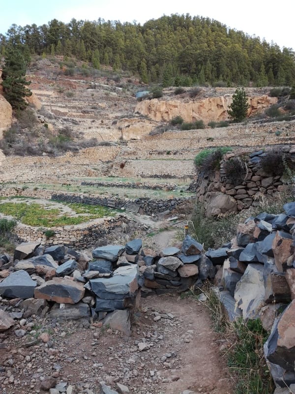
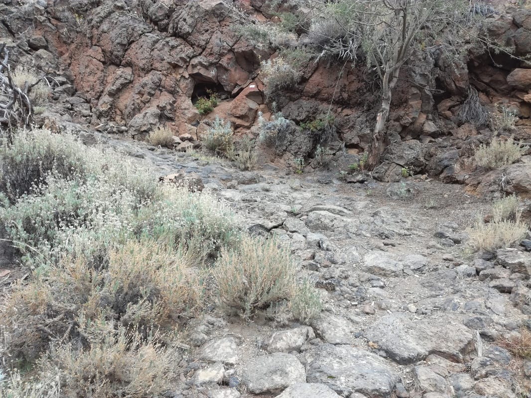
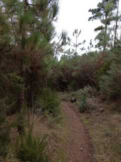
Arriving at El Portillo, I wasted a half an hour looking for the restaurant for a quick coffee and the start of the path down the north side of the island. Amazingly this path - still the GR131 - wasn’t signposted as such from El Portillo, but I knew it could only be the path leading north from the road junction, so off I went at about 1.45. The forest on the north side of the island seems to reach higher up the mountain and the first section is a curious mix of pine forest and desert plants. The past descends relentlessly through the thick forest, often quite steep but now way-marked again. There are small sections of old cobbled mule path - I think these may be remnants of the ‘royal routes’ that the Spanish built after invasion of the islands in the 15th/16th centuries, rather than pre-hispanic guanche routes.
|
|
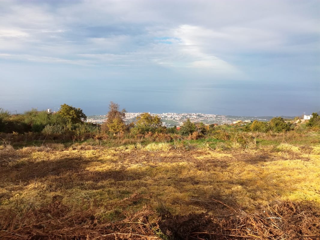
After crossing countless barrancos, heading downhill and north-east all the time, the first glimpses of the sea and Puerto de la Cruz far below came through the trees. By the time the path descends to about 1200 metres, the forest becomes less harsh, with grass, moss and shrubs appearing between the pines.Since El Portillo, the path had been signed to ‘La Caldera’, a village to the east, and above La Orotava. As I couldn't get there by the time the bus passed, I decided to cut off to the left 4km short of la Caldera, directly downhill, aiming to arrive at the main road at La Chasna to intercept the bus. After cutting through some fields on a back road, I arrived at a main road with bus stop about 15 minutes before the bus was due.
|
|
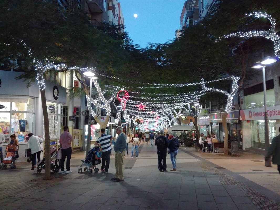
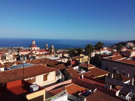
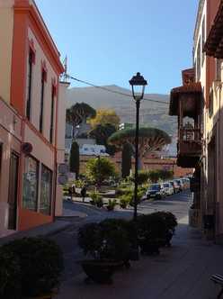
After half an hour, I began to wonder if the bis would come but just as I was about to walk off, a bus arrived round the corner. However, this was the 347 to Realejo Alto, not my direction at all - I was at Benijos on entirely the wrong road, the TF326! The main TF21 road was in fact a couple of km to the east as I had cut off from the main path too early. The rest of the evening (dusk was now falling) I spent slogging downhill along increasingly urban roads until eventually I reached La Orotava itself a little before 8 o’clock; a lovely town, with many houses as old as those back in Edinburgh. The Hotel Victoria has a nice roof terrace and a wonderful restaurant.
|
|
Day 4: Puerto de la Cruz
That was really the walk pretty much finished. However, having got so far by foot alone, I thought iI should finish by walking down to the coast at Puerto de la Cruz, a total of some 4km (after over 40 the previous day). I anticipated that crossing the TF5 motorway would be the biggest obstacle but saw on a map a promising route down Camino San Bartolomé. I was pleased to see a pavement on the slip road crossing the motorway so took this to arrive on the opposite side - which ended simply at a bus stop with no further pedestrian route! But cutting across the verge, I managed to climb down into a back street which did indeed turn out to be the Camino San Bartolomé and this led to the outskirts of PdlC. This is quite a big town with several districts, heavily built up and very touristy of course, but I quite liked it, and the hotel Las Vegas a real tourist hotel but with dirt cheap cocktails (3 euros) and an amazing breakfast. On the way back I visited the capital Santa Cruz by the tram and found a Christmas fair kiosk selling home-made cakes from Vilaflor which seemed too good to miss as something to bring home.